- MTB
- Belbins Road (Stringy Bark Gully)
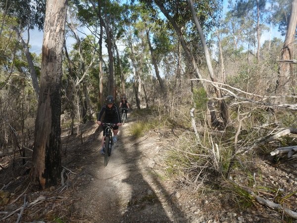
Belbins Road (Stringy Bark Gully)
Hot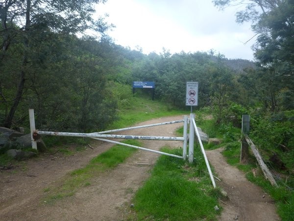
Key Statistics
Distance
5-6kms
Grade
Duration
Single Day
Time (hrs)
1-2 hours
Last Visited
June 28, 2014
Land Tenure
- Nature Recreation Area
Trail Category
Location
Region
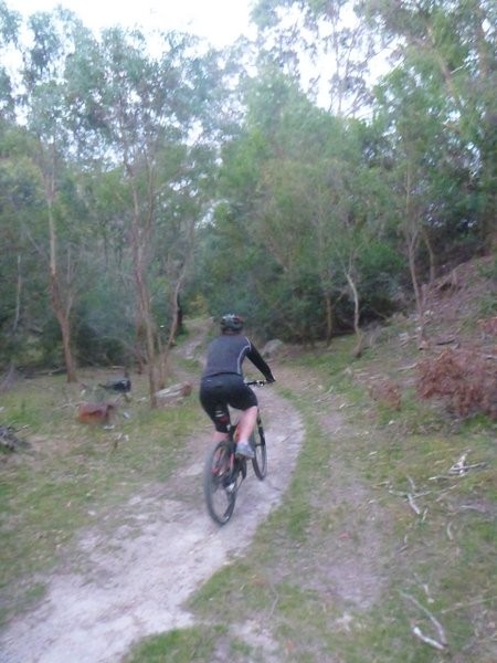
Starting at the end of Belbins Road there is a growing network of tracks and trails all over the Meehan Ranges which make a great playground for beginner through to advanced riders. Whilst most people now head straight up into the Meehan Ranges, there's still some great riding to be had in Stringy Bark gully itself directly off Belbins Road, especially for those who just want an hour or so on the bike. Also check out the Meehan Ranges and Clarence Mountain Bike Park notes for other rides in the area.
If coming from the Sorell or Richmond direction then follow the highway signs to Cambridge and then from the Richmond Road junction in Cambridge (across from the BP) follow the B31 towards Hobart for 2.1kms. The main road swings left and goes under the highway, but you want to turn right here (don't go under the highway) onto the well signed Belbins Roadand again follow this 300 metres until the end.
Dogs and horses are allowed in this area, so ride like you might find one around the next corner.
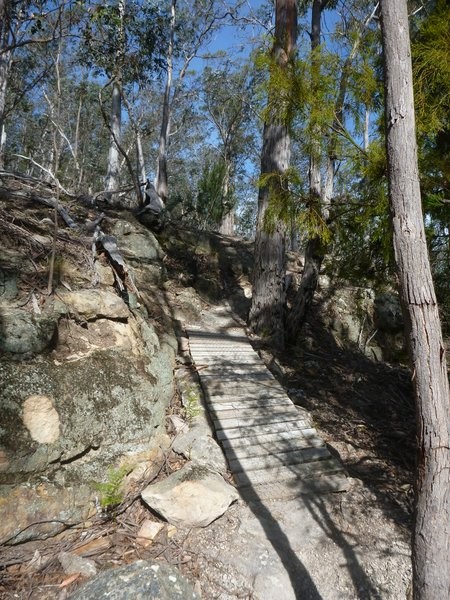
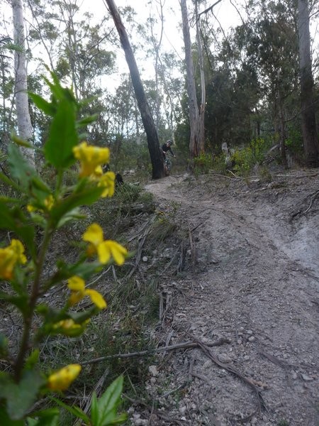
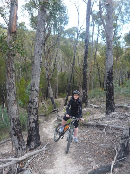
Head into the reserve past the white boom gate. Almost immediately you will come to a junction with one trail going up to the left and another heading down on the right. Take the left junction and head up and work with the principle that you are heading around this gully in a clockwise direction.
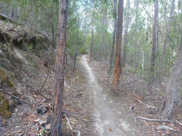
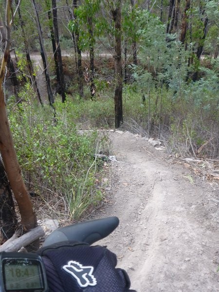
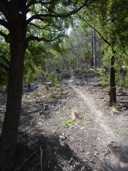
You'll come out into an open area (mostly on your right) 200 metres from the boom gate with lots of tracks leading off, you can explore here later but for now continue on the track you are on as it turns slightly to the left and becomes a little rougher. 350metres from the gate you will see a couple of singletrail leads within 20 metres of each other on your left. Shift down into an easier gear and head up one of these (I'd recommend the second one, but they join together straight away).
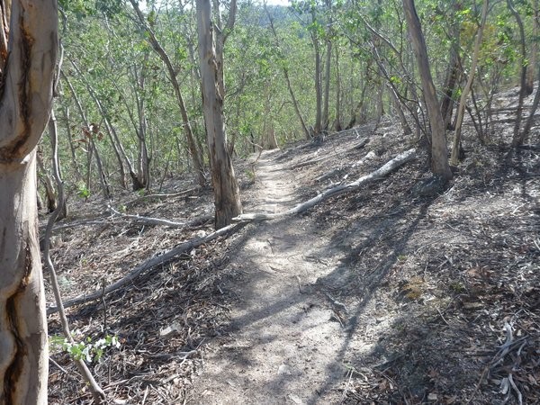
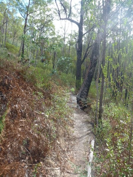
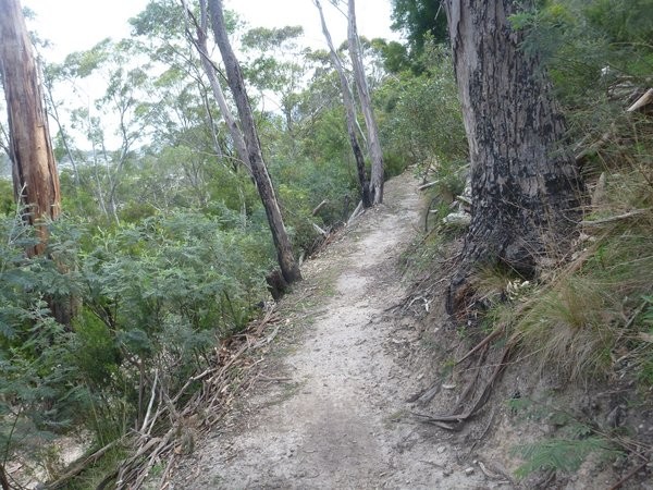
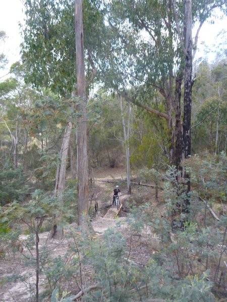
This single track climbs slightly up the gully side before flattening out and then branching (500m). Take the left fork and start following this around into a side gully. Another 150 metres on there is another turn off to the right, which is an exit option for beginner riders who otherwise might find themselves pushing the next couple of hundred metres before returning to pretty much where you are now. For most other riders head up and then back down some steep switchbacks before entering an old creek bed with some fun (but short) technical riding back down again. The track you're on then climbs back up another set of switchbacks on the other side of the little creek before another fun run down onto a significant trail roughly 1.3kms from the start.
Turn left onto this trail and follow it for 200 metres until you see another short section (about 250metres) of single trail heading up to your left just as you enter an open area. This short section of trail is a nice little climb and a fun descent (with one or two challenging gullies). You will see another section of single trail heading off to the left about 150 metres into this trail which should be ignored. Once again this will drop you down onto the main trail, so turn left and then just follow the main trail up the gully for the final 1.3kms until you get to the blue park sign and you will see the somewhat intimidating climb heading off to your left which is the official walking route up onto the top of the ranges (avoid this trail on your mountain bike) and heading off to your right you'll see a newly constructed (September 2013) MTB trail which heads up onto the fireline track into the Meehan Ranges.
Turn around here, and almost immediately (20 metres down the trail) look for a single trail trailhead on your right (as you're heading back down the gully) and jump onto this. This is another short (450 metres) but lovely section of trail with some nice log features. However, beware of the final descent back onto the main trail - it is a steep descent into a sharp gully and is for advanced riders only.
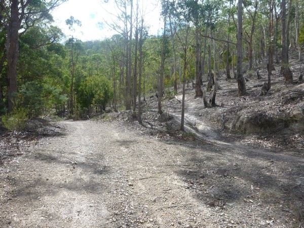
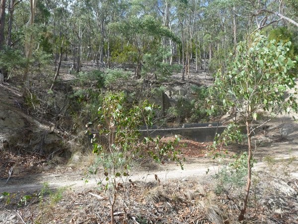
Back on the main trail, turn right and head down for about 400 metres where the trail forks, take the left fork and then just follow your wheel. This trail branches in several places, but only ever for a short while, as you flow down and through a big old open quarry (500 metres from the junction) continue to follow the trail through the quarry and out the other side (make sure you don't exit on the main track, you want to jump onto the single trail which is on the up hill or left hand side of the track).
100 metres from the large quarry keep your eye out for another trail heading in from the left just before you pass a concrete loading slab in another small quarry. Although you'll continue straight ahead now, this trail is another option for heading up onto the ridge (though it was built mainly as a downhill descent and I wouldn't recommend riding up this way anymore).
For now just continue down the trail you're on for another 200 metres at which point it swings around to your left and down through a nice little section of bush and out into an open area where the tracks starts branching again. You are just about to head into that open area you saw 200 metres into the park, so just keep going forward (doesn't matter which track you take) and you'll come out into that area.
The way back to the car is straight through this open area and then it's just another 300 metres back out to the carpark entrance.
Alternatively, just as you come out into the open area you will cross a track which heads off to your left and across the gully and up the hill. This is the start of the Meehan Ranges route, and even if you don't want to go to the top is an excellent area of tracks you can go an play.
The Meehan Monster Facebook Page
Hobart MTB Rides Facebook Group
Hobart Trail Groomers Facebook Group
Tassie Rambler Blog 28 June 2014
GETTING THERE
To get here from Hobart, head over the Tasman Bridge and follow the A3 as though going to the airport. 6.5kms after driving off the bridge you'll see signs for an off ramp towards Richmond and Cambridge. Take this exit and 300 metres after you turn off the highway you'll see the well signed turnoff onto Belbins Road to your left. Follow this road 300 metres to the end and park somewhere around the roundabout, making sure you don't block the road.If coming from the Sorell or Richmond direction then follow the highway signs to Cambridge and then from the Richmond Road junction in Cambridge (across from the BP) follow the B31 towards Hobart for 2.1kms. The main road swings left and goes under the highway, but you want to turn right here (don't go under the highway) onto the well signed Belbins Roadand again follow this 300 metres until the end.
FACILITIES
There are no facilities at the park. The nearest services are back in Cambridge.WARNINGS
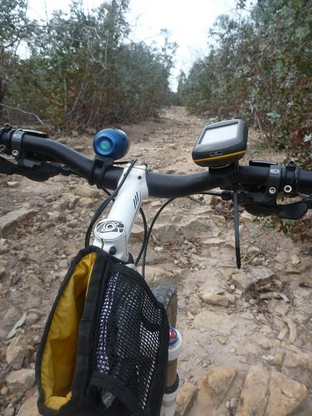
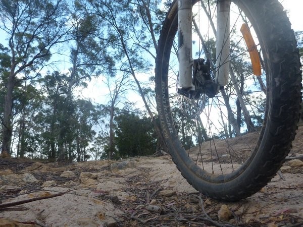
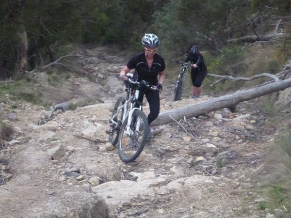
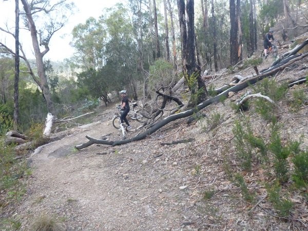
There are a lot of trails built in this area and the quality (while improving) really varies so you need to be careful and expect the unexpected in terms of what may be around the next corner. By way of example I was riding around some switchbacks here just before I wrote these notes and the side of the track just disappeared out from under my front wheel and I was flying over my handlebars before I even knew what happened. On inspection the track had very soft edges and had just collapsed.Dogs and horses are allowed in this area, so ride like you might find one around the next corner.
ROUTE DESCRIPTION
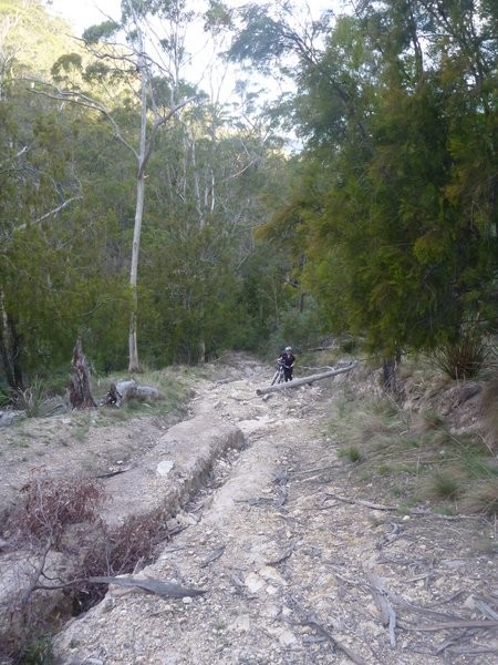
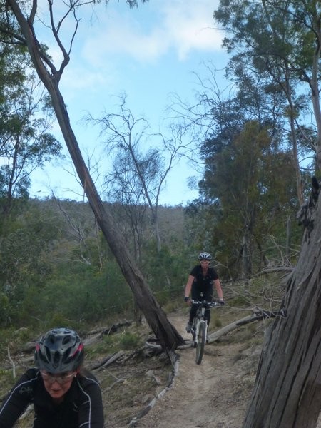
Really this reserve is small enough that you can just go out and explore and you'll find most of the trails ... eventually. There is a central track which runs up the middle of the gully alongside the dry creek (actually for most of the way there are two main tracks one on either side of the creek) and the single trail heads off to the left and right of these main trails. There is no correct way to ride most of these trails, so the route below is more of a cheat sheet guide to get you onto some of the better trails. Once you have got your head around the main trails, just go play.Head into the reserve past the white boom gate. Almost immediately you will come to a junction with one trail going up to the left and another heading down on the right. Take the left junction and head up and work with the principle that you are heading around this gully in a clockwise direction.
You'll come out into an open area (mostly on your right) 200 metres from the boom gate with lots of tracks leading off, you can explore here later but for now continue on the track you are on as it turns slightly to the left and becomes a little rougher. 350metres from the gate you will see a couple of singletrail leads within 20 metres of each other on your left. Shift down into an easier gear and head up one of these (I'd recommend the second one, but they join together straight away).
This single track climbs slightly up the gully side before flattening out and then branching (500m). Take the left fork and start following this around into a side gully. Another 150 metres on there is another turn off to the right, which is an exit option for beginner riders who otherwise might find themselves pushing the next couple of hundred metres before returning to pretty much where you are now. For most other riders head up and then back down some steep switchbacks before entering an old creek bed with some fun (but short) technical riding back down again. The track you're on then climbs back up another set of switchbacks on the other side of the little creek before another fun run down onto a significant trail roughly 1.3kms from the start.
Turn left onto this trail and follow it for 200 metres until you see another short section (about 250metres) of single trail heading up to your left just as you enter an open area. This short section of trail is a nice little climb and a fun descent (with one or two challenging gullies). You will see another section of single trail heading off to the left about 150 metres into this trail which should be ignored. Once again this will drop you down onto the main trail, so turn left and then just follow the main trail up the gully for the final 1.3kms until you get to the blue park sign and you will see the somewhat intimidating climb heading off to your left which is the official walking route up onto the top of the ranges (avoid this trail on your mountain bike) and heading off to your right you'll see a newly constructed (September 2013) MTB trail which heads up onto the fireline track into the Meehan Ranges.
Turn around here, and almost immediately (20 metres down the trail) look for a single trail trailhead on your right (as you're heading back down the gully) and jump onto this. This is another short (450 metres) but lovely section of trail with some nice log features. However, beware of the final descent back onto the main trail - it is a steep descent into a sharp gully and is for advanced riders only.
Back on the main trail, turn right and head down for about 400 metres where the trail forks, take the left fork and then just follow your wheel. This trail branches in several places, but only ever for a short while, as you flow down and through a big old open quarry (500 metres from the junction) continue to follow the trail through the quarry and out the other side (make sure you don't exit on the main track, you want to jump onto the single trail which is on the up hill or left hand side of the track).
100 metres from the large quarry keep your eye out for another trail heading in from the left just before you pass a concrete loading slab in another small quarry. Although you'll continue straight ahead now, this trail is another option for heading up onto the ridge (though it was built mainly as a downhill descent and I wouldn't recommend riding up this way anymore).
For now just continue down the trail you're on for another 200 metres at which point it swings around to your left and down through a nice little section of bush and out into an open area where the tracks starts branching again. You are just about to head into that open area you saw 200 metres into the park, so just keep going forward (doesn't matter which track you take) and you'll come out into that area.
The way back to the car is straight through this open area and then it's just another 300 metres back out to the carpark entrance.
Alternatively, just as you come out into the open area you will cross a track which heads off to your left and across the gully and up the hill. This is the start of the Meehan Ranges route, and even if you don't want to go to the top is an excellent area of tracks you can go an play.
USEFUL RESOURCES
Clarence City Council Park NotesThe Meehan Monster Facebook Page
Hobart MTB Rides Facebook Group
Hobart Trail Groomers Facebook Group
Tassie Rambler Blog 28 June 2014
Photos
Map
Editor review
1 review
Overall rating
3.5
Fun factor
3.5
Technical challenge
3.5
Scenic/cultural/historical value
3.0
Overall rating
3.5
TR
User reviews
There are no user reviews for this listing.
{{#ratings}}
{{title}}
{{#ownerCreatedBlock}}
{{/ownerCreatedBlock}}
{{#category}}
{{#editor}}
{{/editor}}
{{#user}}
{{/user}}
{{/ratings}}
-
{{#owner}}
-
{{#url}}
{{#avatarSrc}}
{{name}} {{/url}} {{^url}} {{#avatar}} {{& avatar}} {{/avatar}} {{name}} {{/url}} - {{/owner}} {{#created}}
- {{created}} {{/created}}
Category: {{category.title}}
{{/category}}
{{#fields}}
{{#showLabel}}
{{/fields}}
{{label}}:
{{/showLabel}}
{{& text}}