- MTB
- Butlers Gorge - Lake King William
Butlers Gorge - Lake King William
Hot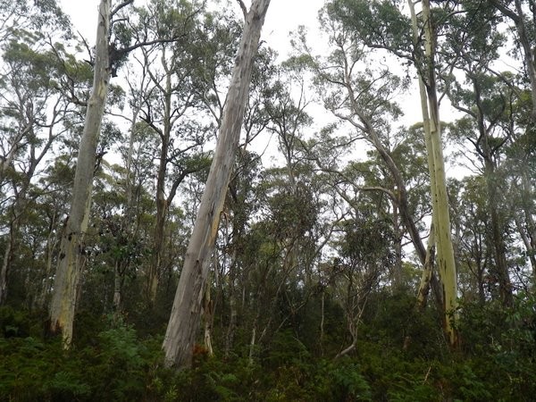
Key Statistics
- State Forest
Location
A hidden gem of a ride connecting Clark Dam at the southern end of Lake King William with Derwent Bridge, this route follows infrequently used 4WD trails alongside the banks of the lake. Combining remote riding along beautiful trails with spectacular bushland and lakeside views, this is a trail to check out before everyone else finds out about it. It is not however for those looking for sweet single trail.
GETTING THERE
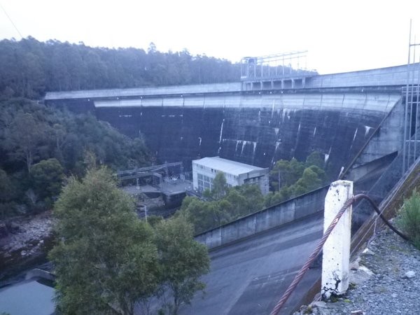
The track can be accessed from either Derwent Bridge at the Northern end or Clark Dam at the Southern End near Butlers Gorge. The Turn off to Clark Dam is 34 kms from Ouse, and is signed to Butlers Gorge / Lake King William. It is a further 16kms along a dirt road from here to Clark Dam. At the dam, follow the signs to the Boat Ramp and park here.
There are pros and cons for each way. Clark Dam is probably the best option if you're just travelling up from Hobart for the day to do the ride (about 2 hours drive each way) and has the advantage of providing the option of a hot meal at the turn around point at Derwent Bridge.
Derwent Bridge is an easier option if travelling through from Hobart to the West Coast or vice versa and once you're on the trail it is easier to follow north to south, but the start of the ride is across private land (which you'll have to detour around) and you will start and finish with a bit of a hill.
ROUTE OPTIONS
This is basically an out and back ride, but don't let that get you down as there are quite a few interesting 'detours' described in the track notes for the explorer at heart.
Potentially, you could make this into a much longer circuit ride (heading out around Laughing Jack Lagoon and 16 mile road) but I've yet to explore this option myself.
It is also possible to get to the Lake King William shoreline by following Harbacks Road which heads off the Lyell Highway about 5km west of Derwent Bridge. I drove and walked out to the shoreline in 2014. So in the right weather conditions, someone with a packraft and a real sense of adventure could potentially make this a circuit, although I have heard quite scary stories of conditions on the lake so don't take this as a recommendation.
WARNINGS
This is a remote area ride with an average elevation of around 750metres and you're not likely to meet many others out there. The conditions can be freezing and the wind a torture if you're not correctly attired. Make doubly sure someone knows where you are and again, this is the sort of ride I take a Spot Tracker with me on.
ROUTE DETAILS
From the Boat Ramp, retrace your steps about 100 metres along the road back towards the dam until you hit another road coming in from the left, and turn up this and begin a small climb over the headland.
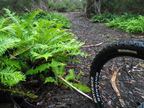
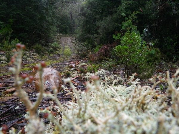
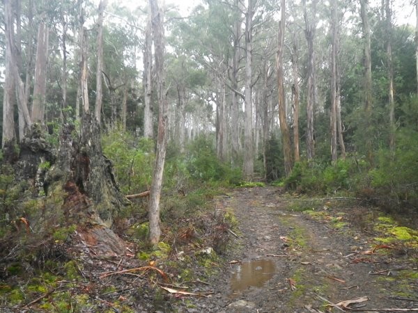
The start of the track is on very coarse blue metal and doesn't make for the best riding.
About 2.2km from the car near the bottom of a short downhill look for a small track heading off to the right and take this. This is only a short detour (500m) before returning to the main track, but it's a nice taste of what's to come.
You'll rejoin the main track and follow this alongside the lake, until about 5.5kms from the start where the track branches and you head inland (the other option looks like it runs straight ahead onto the lake shore).
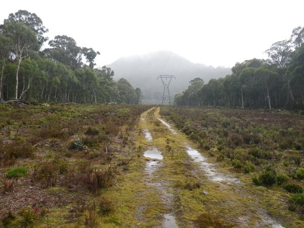
The track weaves under and around powerlines, and towards and away for the shore, but just keep following the main track and you'll be fine until 12.3kms from the start where you'll see a track heading off on your right directly away from the lake. You'll be cycling alongside some powerlines at this stage.
You have two options here (assuming the lake is low enough).
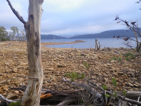
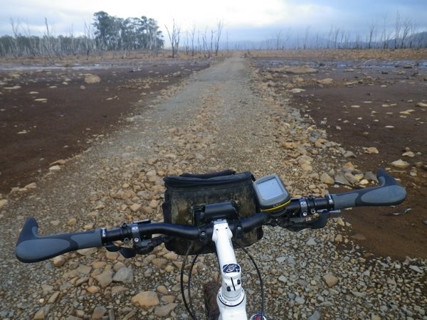
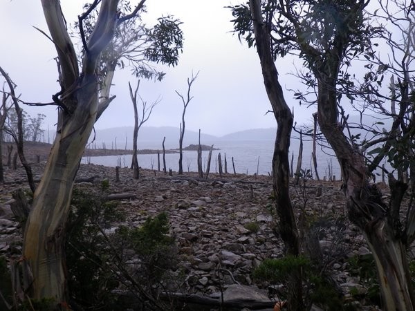
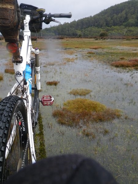
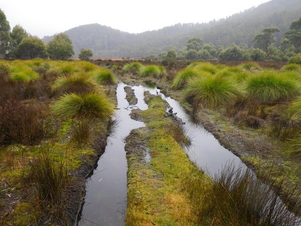
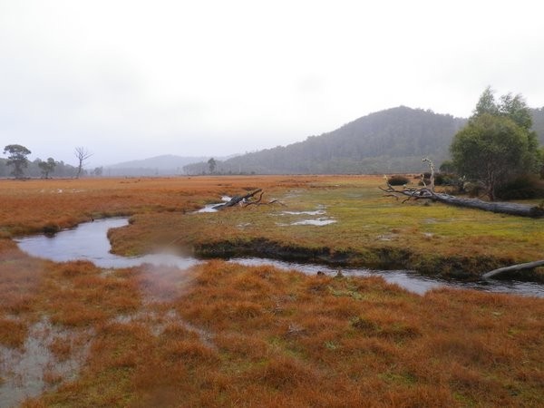
The fun option is to continue straight ahead on the track you're on, which will get increasingly wet and boggy andf ultimately drop you out in a big wide open bay. Your task is then to push and ride your bike across this bay to where you'll see the power poles in the distance (it's about 1km across in a direct line in a NW direction), but best to stay close to shore as the groud is very boggy.
It really is a lovely crossing, completely different from the rest of the track, but you will get soaking feet and there's one or two spots where anyone with a fear of quicksand will be freaking out as you can feel that if you break through the reeds on the surface you'll go plunging down into the boggy peat soils below.
About half way across the bay your destination will become more obvious. You'll see a couple of power poles and what looks like a track running under them. You'll also see increasing signs of 4WD and motorbike trails which have ridden across the bay. I found about 2/3rds the way across, by sticking close to the shore I was able to get enough solid ground to get back on and ride. There's no set place to rejoin the track - you can aim for the bit of track I mentioned, and you'll discover a few other ways onto the track as well which are too difficult to explain.
Obviously, the other option is to turn right and follow the track as it makes a big detour inland around the boggy bay, but which will ultimately land you at the same spot (I'd recommend coming back this way). There was one significant (knee deep) creek crossing going this way, so you'll get wet feet no matter which way you go, and with the number of downed logs on this section, it probably takes longer to ride around than go through.
Once back on the track, you sidle around the bay for a short period, before hitting the base of the one climb of the day. This is a steep little pass, which all but the fittest riders will end up pushing, but on a clear day you will be rewarded with a unique view out over Lake St Clair and the peaks beyond.
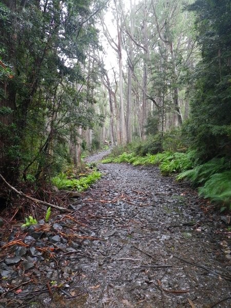
The first few hundred metres of the descent down the other side is quite technical riding (steep with large loose rocks) but about 2/3rds the way down the hill, a road (your return route) comes in from the right and after that the remaining down hill is much easier. Follow the muddy track down and around to the right away from the power lines and you'll find yourself back in some lovely eucalypt forest. From the powelines, follow this track for 1.4kms, at which point another track comes in from the right, continue straight ahead and after another 800 metres you'll drop out in Derwent Bridge.
The last few hundred metres of this route appears to be across private property (there is a no entry sign at the exit point). When I came out this way, I met a lady walking her kids through here and she told me it's fine for cyclists and walkers to go through, just not vehicles, however if that advice changes please leave a comment and let others know.
The alternate route is described below.
At Derwent Bridge you can either head to the cafe (head right and it's a couple of hundred metres up the road) or if you turn left, there's the pub.
Once refueled, head down the highway (Hobart direction) you'll pass the Wall of Sculptures after about a kilometre, another kilometre down the road on a left sweeping bend you'll see a small track heading off to the right, you can go up here, or continue on for another 200 metres and head up a major gravel road heading off to the right (there is a "Wall of Sculptures 1km sign" here). If you take the earlier track, you'll cut onto this road anyway.
Follow this gravel road uuuupppphill for 2.6kms ignoring a couple of junctions heading off to the left. At 2.6kms you come to a junction. The easy option is to turn left, and after a brief climb it's then a quick trip back out to the power lines about half way up the hill. You can however continue straight ahead in which case the road drops back down to the junction just behind the private property boundary where you can turn left and follow your tracks out that way (much more scenic).
Either way, you're now basically following your steps back to Clark Dam. Obviously for those who walked across the bay, this time just keep following the track. It is a fair detour inland, but pleasant riding.
At 2.8kms from where you rejoin the main track, you'll emerge out of the bush and come out under the powerlines next to the lake. There is a track here that heads down to the right. Assuming the lake is low enough, this is a great little detour as you'll find yourself actually cycling inside the lake. It's kind of a surreal landscape (plus there's lots of fun logs, and rocky sections to practice your skills on). Just keep following the track back the way you came from and eventually it relinks with the outward track.
For the adventurous there are a few other sections where you can try cycling inside the lake (eg. parrot corner) but I found I ended up carrying rather than riding my bike through most of these sections.
Regardless, just have a good time as you make your way back to your car.
If coming in from the Northern end, it's worth heading over to Clark Dam (all roads lead to the Dam). There's a car park and viewing section just above it which would make a nice lunch spot.
Photos
Map
Editor review
Review

User reviews
Resources
Blogs, Articles etc.
-
{{#owner}}
-
{{#url}}
{{#avatarSrc}}
{{name}} {{/url}} {{^url}} {{#avatar}} {{& avatar}} {{/avatar}} {{name}} {{/url}} - {{/owner}} {{#created}}
- {{created}} {{/created}}