- MTB
- Dial Range
Dial Range
Hot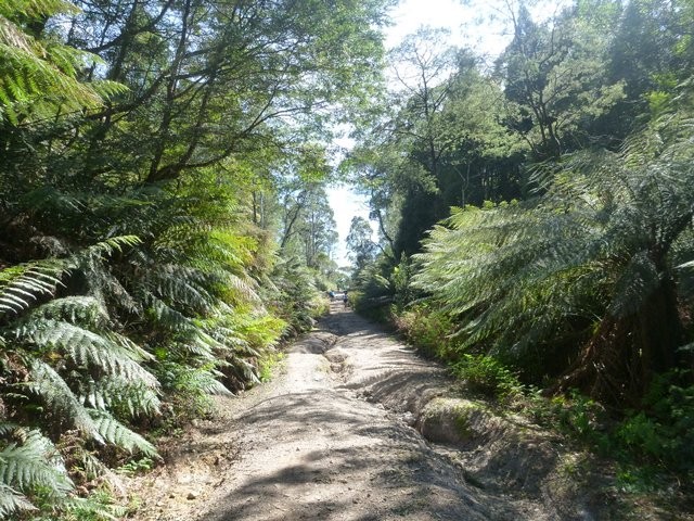
Key Statistics
- State Forest
- Regional Reserve
Location
Thanks to the efforts of the Cradle Coast Mountain Bike Club, many of the old forestry trails in the Dial Range have now been stitched together with some singletrack sections to provide a wonderful, but still infrequently ridden, world of climbing and descending. The route described here follows the sections of the Cranky Penguin race that are open outside of the race event (also see the Penguin MTB Park) and while I'd recommend the race as a great time to ride these trails (and enjoy sections not open during the rest of the year), it can be really enjoyable to explore these trails and forests at a more leisurely pace as well.
GETTING THERE
The easiest way to find your way to the start, regardless of whether you're coming from the Burnie or Ulverstone direction, is to look for the signed turnoff to the Penguin Sports Centre (it is signed "Dial Regional Sports Centre" if coming from the Ulverstone direction).
Follow these signs off the highway onto South Road and towards the Sports Centre. About 600 metres south of the highway, there will be a sign telling you to turn right onto Complex Avenue towards the sports centre. Ignore this and continue straight ahead. Although you remain on the same road it changes name from South road to Dial Range Road at this point. You may want to reset your odometer here if you're unsure of where you're going.
About 2kms from the Complex Avenue junction, you'll get to the crest of a small hill and the bitumen stops at about the same time. Continue along this road (there's a few driveways and turnoffs) and if you're going the right way then about 4.8km from the Complex Avenue junction you will pass a large and obvious motocross raceway circuit on your left. If you're not too confident in your car or driving, you may want to park here and ride the next bit, but you will be leaving yourself a steep climb to finish the ride on.
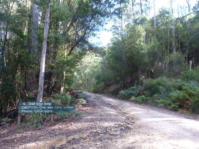
For most people, I'd recommend continuing on in your car and heading down the hill (which is steep) and across a small creek (5.6kms) and then head another 300 metres up the hill in front of you until you get to a junction signed "Trail Bike Area - CAUTION one way trail system".
These track notes assume you park here (there's enough room for a few cars, but make sure you don't block the track) but just so it's said, I personally prefer to turn left at this junction and head down into the Trail Bike Area and park down near the small river (300 metres) or at the junction of the two loops (450 metres from the turn off with the added bonus that you go past your car part way through the ride) so that I don't have to finish my ride on a steep little climb (yes, I am that lazy). There is however very limited parking down there and the track out is steep and can be slippery. Wherever you park, don't block the trails as they are used quite frequently by motorbike riders and 4WD vehicles.
FACILITIES
There are no facilities at the start of this ride. Penguin is the nearest town with shops, toilets etc. and has pretty much everything you'd want. The nearest bike shops are at Ulverstone or Burnie.
ROUTE OPTIONS
Due to this ride being in two loops, you do have the option of bailing out part way through if you find it is all too much for you. The ride is best ridden in the direction described.
An option for the explorers is a walk to the top of Mt Duncan. I've included the route, downloaded from www.thelist.tas.gov.au, for those who may want to consider this option. I've not done it myself, but the junction for the start of the walk is well signed on the ground.
WARNINGS
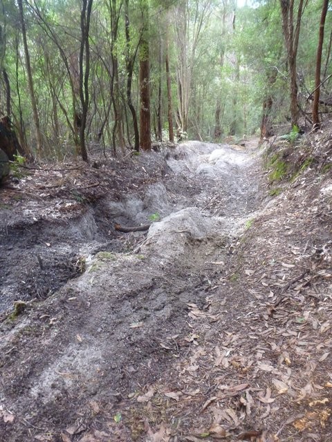
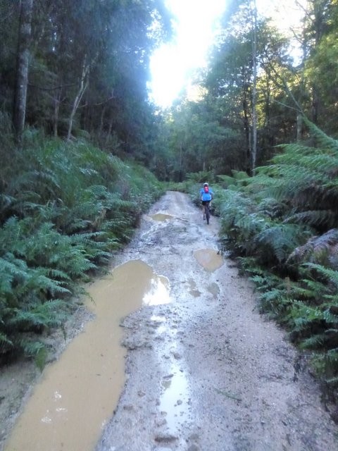
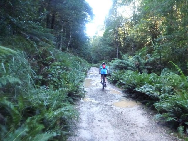
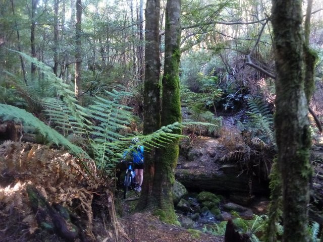
If this tracks not climbing, then it's probably descending so you can climb somewhere else. It has plenty of washed out ruts on the downhills that can take you by surprise. There's also some steep drops, a few creek crossings, some slippery bridges and of course there could be downed branches or trees over the track. These things shouldn't impact on your enjoyment if you're scanning ahead and riding at a sensible speed, but they're all serious hazards if you start being stupid.
Some sections of the trail are used by motorbike riders and walkers so keep your eyes and ears out for them, but at the same time don't assume if you get into trouble that someone will likely come along. Some sections of the track are very seldomly used.
I had phone (Telstra) coverage for most of the ride, but don't take it for granted.
ROUTE DESCRIPTION
From the trail bike sign area, continue up the hill. After about 0.4kms you'll go through a small open area (old quarry) and the track swings around to the right and heads steeply up a short hill. At the top of this hill (0.5km) the track branches, you want to go up the left fork and then just continue on up the undulating climb.
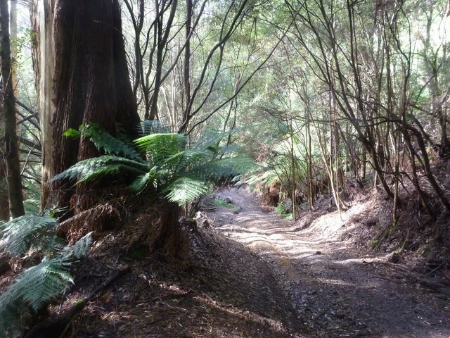
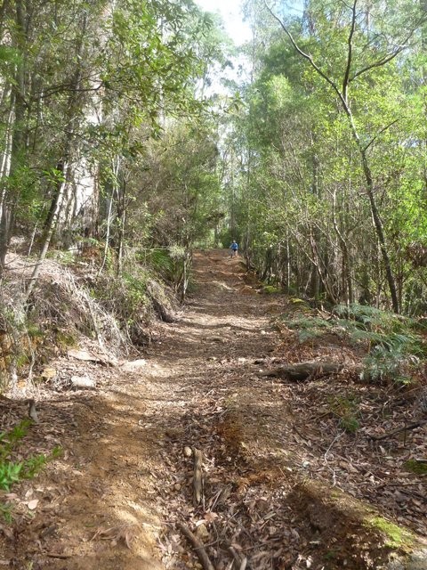
This next section is a nice climb along a 4WD track and is certain to warm up the lungs and legs. Less experienced riders shouldn't be surprised to find themselves pushing a few of the steeper pinches on this section. You'll pass a couple of signs to the Mount Dial and Tall Trees walking trails on the way up, and then at about 2.7kms from the start you'll come around a corner and find yourself dropping out onto a good gravel road (Ironcliffe Road).
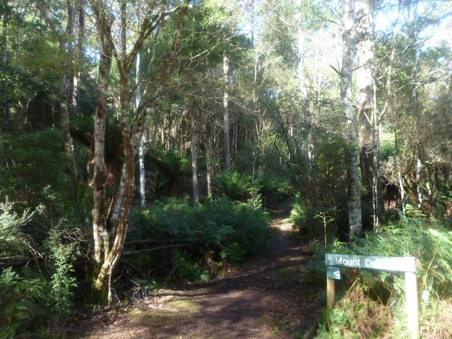
Continue up Ironcliffe road (so turn left onto it) and follow it as it gently climbs for another 2.3kms to the highest point of the road at 5kms from your car. Again this is a lovely old road and very enjoyable riding. When you get to the highest point of the road you should see two roads heading off (the one you're on which heads down the hill in the direction you're going and a less used one coming in on your left). You should also see a green sign in front of you pointing to Mt Duncan. This is the way you want to go, but just for reference you are about to head out and do a loop which will bring you back to this spot coming up the road in front of you and then you’ll head down the old track on your left. This means if you have anyone with you who is struggling a bit, they could wait here for you and have a break (they'll hate themselves if they do though).
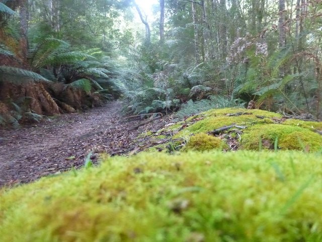
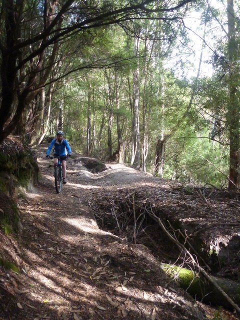
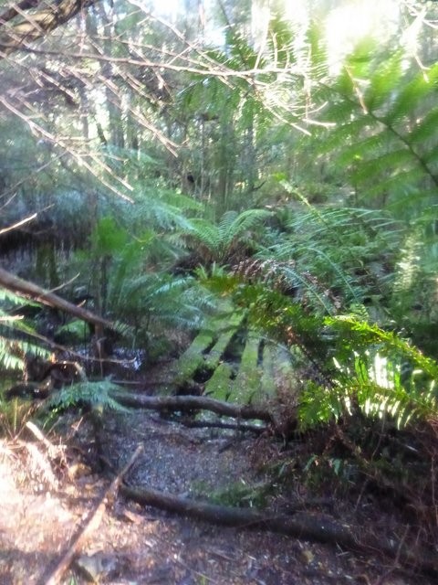
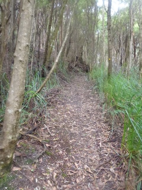
With that sorted, head up the Mount Duncan Walking Trail and you'll find yourself on some challenging singletrack with a few tricky drops, but also some great riding as you continue to gain a bit more height. 100m or so after you start riding the Mount Duncan Walking Track (after leaving Ironcliffe Road) there will be a sign reading "Mount Duncan" which points to a walking track on your left. Ignore this track and continue straight ahead. At 5.7kms from the start you'll come to a small wooden bridge across a creek and a short (100 metre), but darn near vertical climb up a small ridge and then a final little bit of single track before you emerge out onto a lovely overgrown track (5.9kms). From here you turn right and enjoy a fun 1.6km downhill run down this old track. At 7.6km from the start, you'll have to dismount and carefully carry your bike across a little creek before connecting onto the track on the other side. Continue up this track for less than 50 metres where you will emerge out onto a T junction. You are now back onto ironcliffe road. Turn right here and just follow your nose 1.6kms back up to the junction you came through at 5kms (9.2kms).
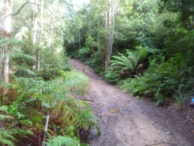
Back at this junction, you can now head down the track that was on your left the first time you came here (technically this is called Dial Creek Road). This is a fun descent, but there are some big washouts on the way down, so be on the lookout for what's up ahead. Approximately 12.2kms from the start you'll drop down a last short, steep descent and will now cross a creek. The track turns left here and criss-crosses the creek a couple more times over the next five hundred metres. At about 12.8kms there is a Y junction, where you want to take the right fork (though it doesn't really matter) and then at 12.9kms you'll drop out onto a major road at a sort of four way junction (you may have parked your car here). At this point there is two tracks heading off to the right (the one directly on your right goes up a hill and the other seems to go around it) and one to the left. You want to take the track heading up the hill, but for those who have found things a bit tough, you can just turn left here and it is 450 metres back to your car.
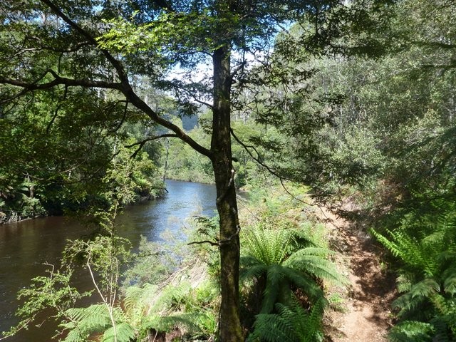
Heading up the hill, you'll find yourself on a well maintained gravel road. The climb goes on until about 15.8kms from the start where you need to have good brakes as you fly down the next 1.2kms (17kms). Just before you get to the river, you want to cut off to the left and jump onto some single track through a grassed area which gets you onto the track running up beside the river. This is a lovely, and pretty flat, section of riding as you follow the river for about four kilometres to a track junction (21kms). Be careful along this section however as there are several creek washouts and slippery logs which will require a dismount and carry.
At 21kms you'll come out into an open area where 4WD's come to, and you need to turn left away from the river and follow the obvious road for 800 metres back up to the junction you were at back at kilometre 12.9. You will now be about 21.8kms from the start. Just continue from here down the road as it plunges down to a creek and then back up one last steep little climb back to your car (22.3kms).
Your choice if you want to do it all again ...
RELATED LINKS
The Cranky Penguin
The Cradle Coast Mountain Bike Club
Tassie Rambler Blog - The Cranky Penguin 2013
Tassie Rambler Blog - Dial Range ride - April 2014
Photos
Map
Editor review
Review

User reviews
Review
Review
Getting There: The signed turnoff to the Penguin Sports Centre reads: "Dial Regional Sports Centre", not "Regional Sports Centre".
Route Description: 100m or so after you start riding the Mount Duncan Walking Track (after leaving Ironcliffe Road) there will be a sign reading "Mount Duncan" which points to a walking track on your left. Ignore this track and continue straight ahead. If you are clever and use the GPX files provided, or are competent navigator (unlike me) you should be right.
[NB - These corrections have now been added to the trail notes - TassieRambler]
-
{{#owner}}
-
{{#url}}
{{#avatarSrc}}
{{name}} {{/url}} {{^url}} {{#avatar}} {{& avatar}} {{/avatar}} {{name}} {{/url}} - {{/owner}} {{#created}}
- {{created}} {{/created}}