- MTB
- Magnet Mine Township (Philospher's Falls)
Magnet Mine Township (Philospher's Falls)
Hot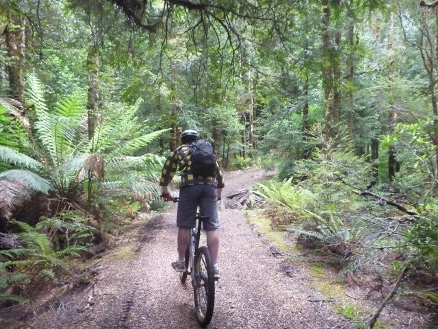
Key Statistics
Distance
28kms
Grade
Duration
Single Day
Time (hrs)
3-6 hrs
Last Visited
December 28, 2014
Land Tenure
- State Forest
Trail Category
Location
This remote loop on the edge of the Tarkine takes you down nine kilometres of abandoned railway, dropping you out at the old Magnet township and mine. Here you can explore to your heart's content, seeing first hand both the scars of our earlier presence in the area and how nature reclaims its own. After exploring the old township, it's a gut busting climb up to the highway and back to the car leaving you with a feeling of having just undertaken your own little Tasmanian adventure. The track notes also include a detour off to the Philosophers falls walk.
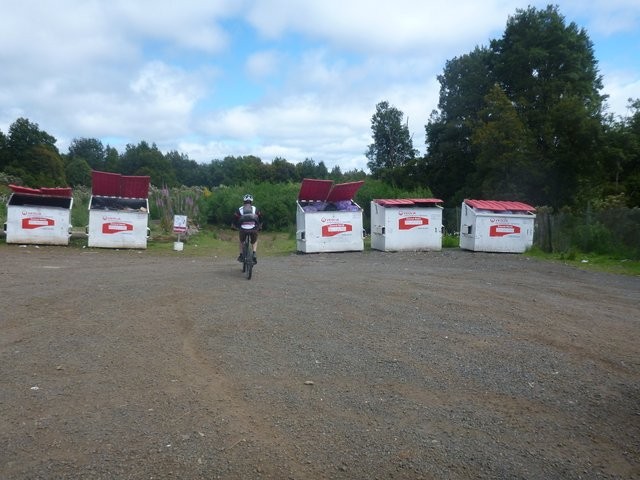
Assuming you come into Waratah from the A10 (so from any of Burnie, Queenstown or Cradle Mountain), then as you enter the town look for the sign to Savage River / Corinna (near the corner store). Turn left onto this road (B23 - Waratah Road) and just follow it 2.3kms until you see the Waste Transfer Station on your right. If coming into Waratah from the Savage River direction, then just keep an eye out for the waste transfer station on your left.
There's plenty of space on the side of the road to park outside the waste transfer station, or you could always just leave your car in Waratah and cycle out to this point.
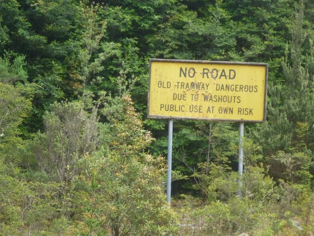
There is no mountain biking signage at the trailhead of this ride (or on the route itself). You have to get around it by yourself.
We had pretty good mobile (Telstra) coverage during the ride, but don't count on it.
I'd strongly recommend following the circuit in the anti-clockwise direction described here, and I'd also recommend starting at the tip in case the trail turns out to be too wet and muddy to ride down. You could however ride in the other direction which would involve a steep road descent into the mine and then a slow, gradual climb back up the railway line which may appeal to some.
You could also just do a down and back up on the railway line.
For those doing the circuit there are two extra options - the first to check out the Whyte Hill lookout (a short 700 metres out and back where magnet road rejoins the highway), and the second a detour (and walk) out to Philosopher's Falls about 2.3kms along the highway from the Whyte Hill lookout (7.3kms before you get back to your car).
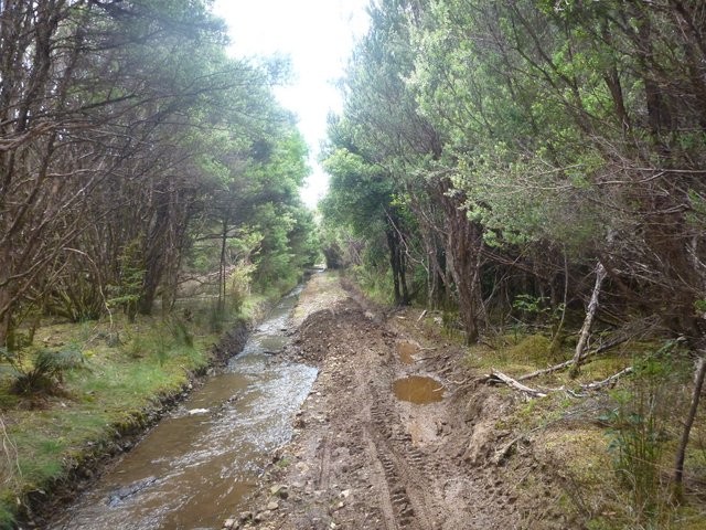
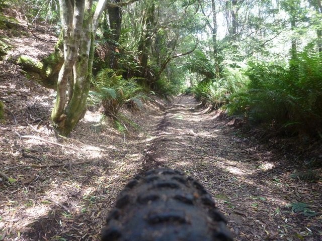
This track, while very easy to follow from a navigation viewpoint, can hold a lot of water and if you find the first couple of kilometers a real wet muddy slog, then you might want to consider the merits of continuing. Hit this trail during a dry spell though and it can be magical.
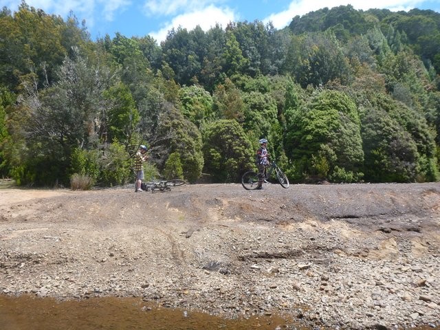
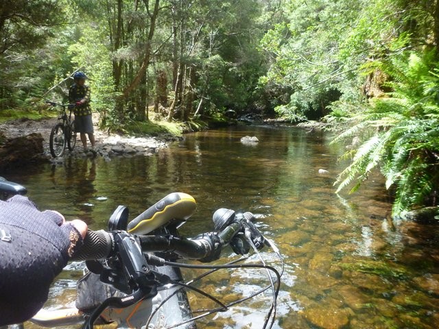
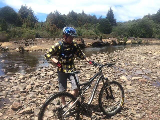
At around the 7.5km point, you will have to ford the Arthur river. This was just a knee deep affair when we crossed it, and it was only a short distance ( < 10 metres across - see photos) but I guess it could be more challenging on wetter days.
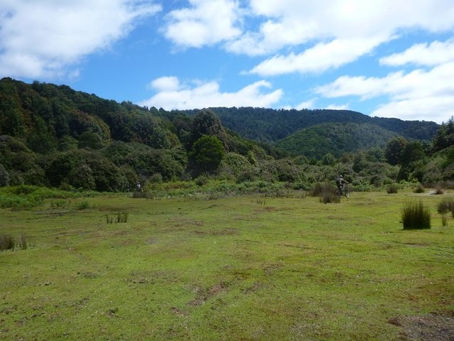
About 1.2kms past the river, you'll come out into the first big open area on your left, and then about 9.4kms from the start (1.9kms from the river crossing) you'll come to the junction of the Arthur River and the much dirtier Magnet Creek. You'll no doubt do what we did and start exploring here, but ultimately you want to turn east and start heading up the 4wd track on the southern side of Magnet Creek (this is shown as magnet road on maps of the area, but the road is now closed and deteriorating).
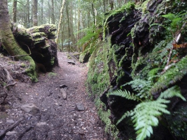
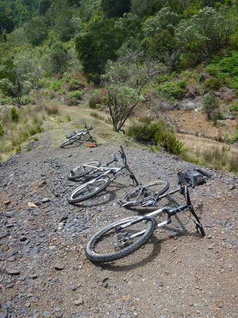
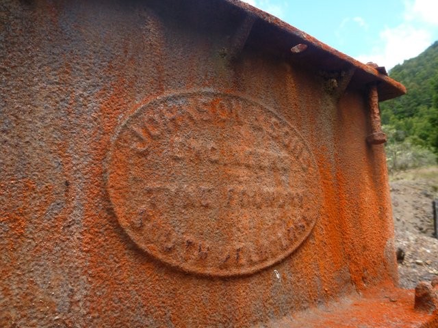
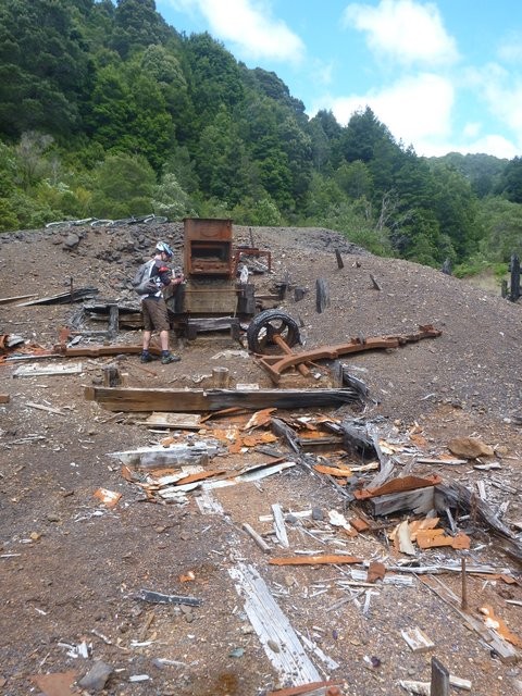
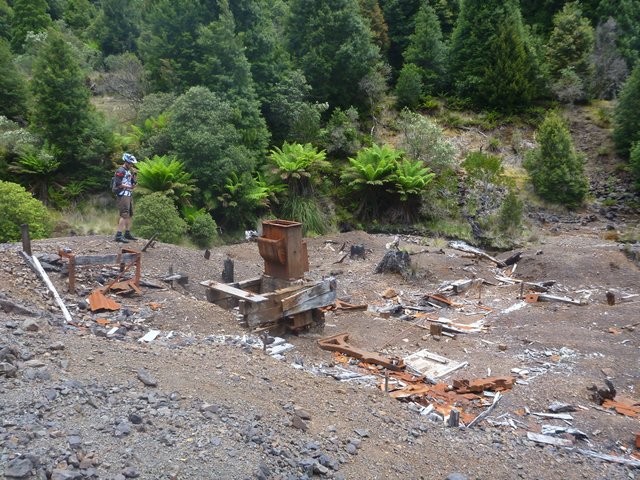
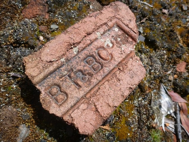
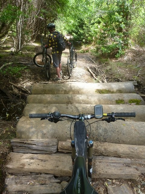
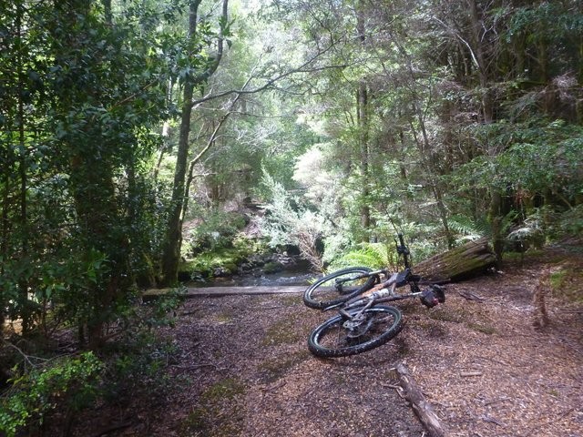
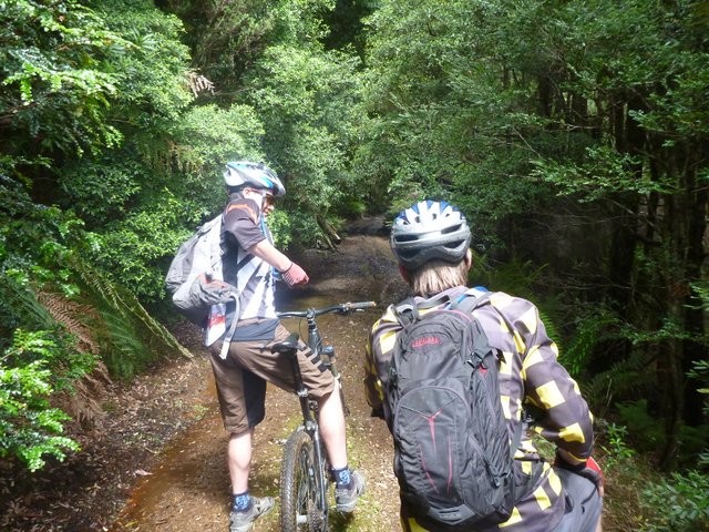
You'll miss a lot if you just race through the next 2.5kms, so budget time to explore the various side trails and old buildings (noting that you are not allowed to disturb or take objects from the old township area). Some sections of the old road (on the Northern side of the river) are now completely overgrown, so the trail follows the southern side until you pass a broken bridge and an obvious old mill site with lots of old gear sitting around. The track crosses magnet Creek just past here (12.2km) and starts heading up the hill. After crossing the river you need to ignore the first track that heads off to the left (this heads up to the Magnet Mine Fossicking Area (See Resources for more information)) and follow the main track as it continues up the hill, and around to the left in the direction you've been heading, but now climbing quite steeply, regaining all that ground you gave up on the way down .
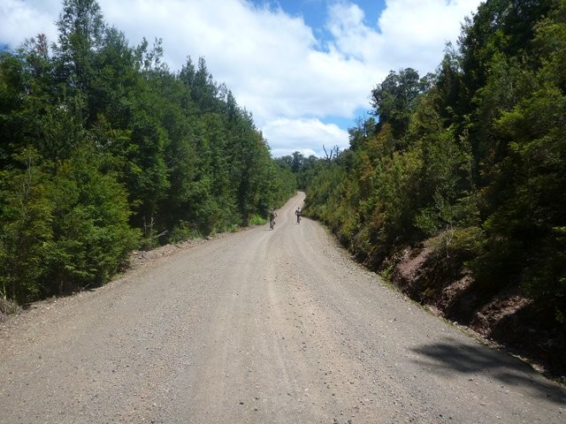
The road is now a pretty good gravel track (albeit with some deep ruts) which you can just follow out to the highway. 13.1kms from the start, you'll cross a small culvert on a sharp bend and you may notice an enticing track heading uphill to your right as the main road loops around to the left. Don't mistake this enticing track as a shortcut, I've not been up it, but according to the maps it is a 6.8km deed end track which takes you up onto Magnet Range and then down the other side to near the start of the Whyte River.
14.5kms from the start, you'll emerge out into a giant quarry which marks the end of the main climb, just follow the road along the southern edge of this quarry and out the other side and from there the road undulates out to the Waratah bitumen highway 17.1kms from the start.
As you come out onto the highway, you'll see the signed road heading up to the Whyte Hill Lookout directly across from you. It's about 350 metres ride up to the lookout, and although the views aren't that special, you are so close it is worth the ride up to check it out.
Once you get back to this junction, just follow the highway back to your car. It's just under 10kms and although there are a couple of small climbs, it's pretty easy and fast climbing compared to the rest of the ride.
Philosopher's Falls
A pleasant detour for those looking to extend their trip, The turn of to the Philosopher's falls walking track is approximately 2.3kms from where you rejoin the highway near Whyte Hill (and 7.3kms from the end of the ride).
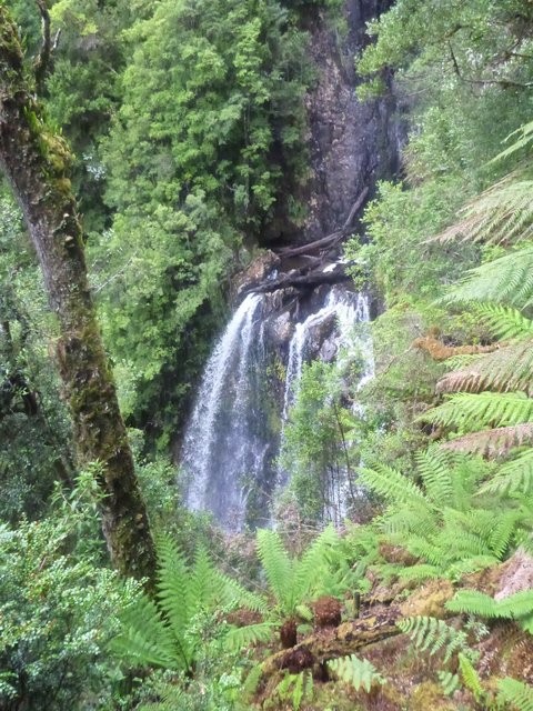
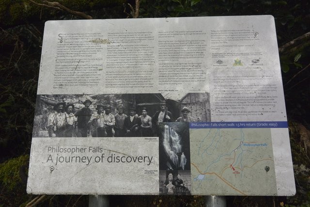
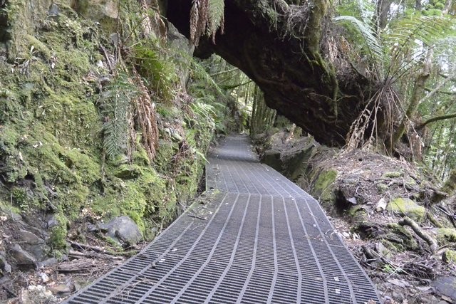
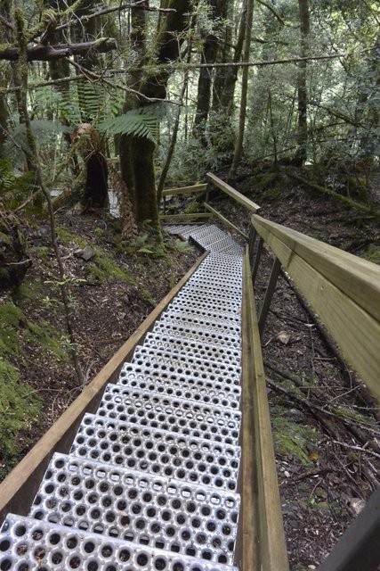
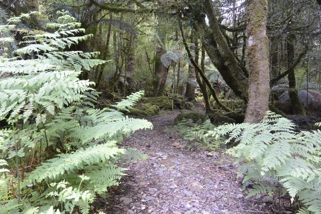
There is good signage showing the way into Philosopher's falls (See Resource for walking notes). It's about a 700 metre drive from the highway down to a small turning circle where the walk starts and a further 1.4km (2.8km out and back) walk to the Philosopher's Falls lookout.
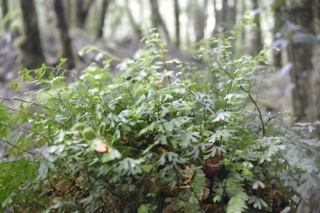
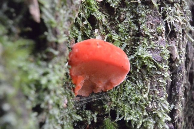
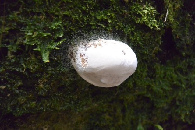
While at least the first half of the Philosopher's walking track (to the creek) is easily ridable, this is a dedicated walking track, so please respect this and leave your bike at the trail-head and walk from there. Although tempted to ride, I walked and was glad I did as it gave me much more time to see and appreciate all of the mosses and fungi I would otherwise have missed.
The falls themselves aren't that spectacular, but the walking is still worth it.
GETTING THERE
This ride starts at the Waratah waste transfer station.Assuming you come into Waratah from the A10 (so from any of Burnie, Queenstown or Cradle Mountain), then as you enter the town look for the sign to Savage River / Corinna (near the corner store). Turn left onto this road (B23 - Waratah Road) and just follow it 2.3kms until you see the Waste Transfer Station on your right. If coming into Waratah from the Savage River direction, then just keep an eye out for the waste transfer station on your left.
There's plenty of space on the side of the road to park outside the waste transfer station, or you could always just leave your car in Waratah and cycle out to this point.
There is no mountain biking signage at the trailhead of this ride (or on the route itself). You have to get around it by yourself.
FACILITIES
There are no facilities at the waste transfer station (unless you want to get rid of your waste and recyclables). Waratah, which is just 2.3kms down the road, has a good public toilet, a charming old style corner store (where you can get a coffee and something hot to eat) and Waratah itself is worth a walk around to check out the falls and historic buildings. There is also camping, basic accommodation (Bischoff Hotel) and platypus crossing signs in Waratah (sorry, but those signs are just so cool).We had pretty good mobile (Telstra) coverage during the ride, but don't count on it.
ROUTE OPTIONS
Unfortunately, no matter how you tackle this ride, you first have to ride down and then ride back up again. Magnet township is about 250 metres below the highway.I'd strongly recommend following the circuit in the anti-clockwise direction described here, and I'd also recommend starting at the tip in case the trail turns out to be too wet and muddy to ride down. You could however ride in the other direction which would involve a steep road descent into the mine and then a slow, gradual climb back up the railway line which may appeal to some.
You could also just do a down and back up on the railway line.
For those doing the circuit there are two extra options - the first to check out the Whyte Hill lookout (a short 700 metres out and back where magnet road rejoins the highway), and the second a detour (and walk) out to Philosopher's Falls about 2.3kms along the highway from the Whyte Hill lookout (7.3kms before you get back to your car).
WARNINGS
This is a remote area ride on a track that on a good day is wonderful, but if no one's been down there for a while and cleared it, then it can be pretty rough with potentially lots of sticks and downed trees. I can speak from experience when I say that if you try and ride this trail when it is wet, then it just isn't fun. The trail also has at least two significant creek crossings (Arthur's River and Magnet Creek). All of this means you need to make sure you are self sufficient in terms of safety gear, food etc. and always let "someone who cares" know where you are and when they should be worried if you're not back.ROUTE DETAILS
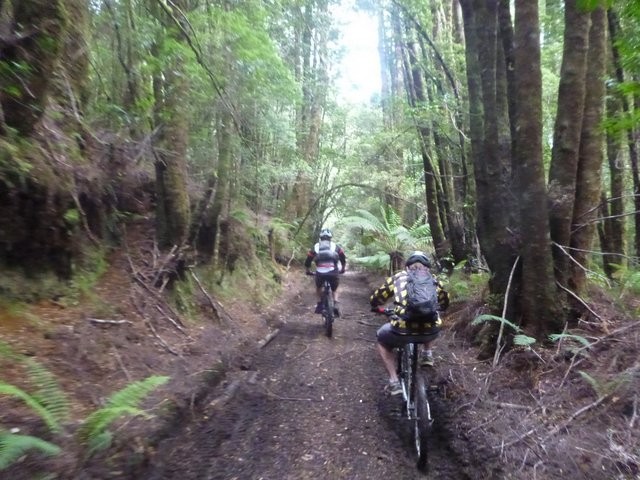
Head into the Waste Transfer Station and look for the overgrown (and unpromising) track heading off into the brush behind it. The first few hundred metres of this track are muddy and overgrown, but you soon enter thicker forest and the track starts to assert itself.This track, while very easy to follow from a navigation viewpoint, can hold a lot of water and if you find the first couple of kilometers a real wet muddy slog, then you might want to consider the merits of continuing. Hit this trail during a dry spell though and it can be magical.
At around the 7.5km point, you will have to ford the Arthur river. This was just a knee deep affair when we crossed it, and it was only a short distance ( < 10 metres across - see photos) but I guess it could be more challenging on wetter days.
About 1.2kms past the river, you'll come out into the first big open area on your left, and then about 9.4kms from the start (1.9kms from the river crossing) you'll come to the junction of the Arthur River and the much dirtier Magnet Creek. You'll no doubt do what we did and start exploring here, but ultimately you want to turn east and start heading up the 4wd track on the southern side of Magnet Creek (this is shown as magnet road on maps of the area, but the road is now closed and deteriorating).
You'll miss a lot if you just race through the next 2.5kms, so budget time to explore the various side trails and old buildings (noting that you are not allowed to disturb or take objects from the old township area). Some sections of the old road (on the Northern side of the river) are now completely overgrown, so the trail follows the southern side until you pass a broken bridge and an obvious old mill site with lots of old gear sitting around. The track crosses magnet Creek just past here (12.2km) and starts heading up the hill. After crossing the river you need to ignore the first track that heads off to the left (this heads up to the Magnet Mine Fossicking Area (See Resources for more information)) and follow the main track as it continues up the hill, and around to the left in the direction you've been heading, but now climbing quite steeply, regaining all that ground you gave up on the way down .
The road is now a pretty good gravel track (albeit with some deep ruts) which you can just follow out to the highway. 13.1kms from the start, you'll cross a small culvert on a sharp bend and you may notice an enticing track heading uphill to your right as the main road loops around to the left. Don't mistake this enticing track as a shortcut, I've not been up it, but according to the maps it is a 6.8km deed end track which takes you up onto Magnet Range and then down the other side to near the start of the Whyte River.
14.5kms from the start, you'll emerge out into a giant quarry which marks the end of the main climb, just follow the road along the southern edge of this quarry and out the other side and from there the road undulates out to the Waratah bitumen highway 17.1kms from the start.
As you come out onto the highway, you'll see the signed road heading up to the Whyte Hill Lookout directly across from you. It's about 350 metres ride up to the lookout, and although the views aren't that special, you are so close it is worth the ride up to check it out.
Once you get back to this junction, just follow the highway back to your car. It's just under 10kms and although there are a couple of small climbs, it's pretty easy and fast climbing compared to the rest of the ride.
Philosopher's Falls
A pleasant detour for those looking to extend their trip, The turn of to the Philosopher's falls walking track is approximately 2.3kms from where you rejoin the highway near Whyte Hill (and 7.3kms from the end of the ride).
There is good signage showing the way into Philosopher's falls (See Resource for walking notes). It's about a 700 metre drive from the highway down to a small turning circle where the walk starts and a further 1.4km (2.8km out and back) walk to the Philosopher's Falls lookout.
While at least the first half of the Philosopher's walking track (to the creek) is easily ridable, this is a dedicated walking track, so please respect this and leave your bike at the trail-head and walk from there. Although tempted to ride, I walked and was glad I did as it gave me much more time to see and appreciate all of the mosses and fungi I would otherwise have missed.
The falls themselves aren't that spectacular, but the walking is still worth it.
Photos
Map
Editor review
1 review
Ramblers REview
Overall rating
4.0
Fun factor
3.5
Technical challenge
3.0
Scenic/cultural/historical value
4.5
Overall rating
4.0
If you hit this loop after a dry spell it's great, but hit it when it's when and it can be a chore.
Review
Would you recommend?

TR
User reviews
1 review
Overall rating
4.6
Fun factor
5.0(1)
Technical challenge
3.5(1)
Scenic/cultural/historical value
5.0(1)
Overall rating
5.0(1)
Overall rating
5.0
Fun factor
5.0
Technical challenge
3.5
Scenic/cultural/historical value
5.0
Overall rating
5.0
Review
Updates
A few comments on the great ride.
Due to some local incorrect comments, we did the route clockwise but very glad we did. We went down the steep gravel road but would not like to have ridden up it. Instead we rode up the tramway route to the tip which was a lovely gentle ride. Plenty of sticks on the path. Along the bottom of the valley, we deviated a few times between the 4WD track and the rail trail which was under a little water at times. There hasn’t been a lot of rain and we had to make the decision at one stage to walk through the water (ankle deep) for 200m. The Arthur river was about calf deep. Any historical bits have been reclaimed by nature
Due to some local incorrect comments, we did the route clockwise but very glad we did. We went down the steep gravel road but would not like to have ridden up it. Instead we rode up the tramway route to the tip which was a lovely gentle ride. Plenty of sticks on the path. Along the bottom of the valley, we deviated a few times between the 4WD track and the rail trail which was under a little water at times. There hasn’t been a lot of rain and we had to make the decision at one stage to walk through the water (ankle deep) for 200m. The Arthur river was about calf deep. Any historical bits have been reclaimed by nature
Would you recommend?
GR
Geoff Robb
Resources
Other Resources
Magnet Mine Fossicking Area (Mineral Resources Tasmania). Useful map shows where the mine is.
Very worthwhile watching before heading down there so you can compare the then and now.
Blogs, Articles etc.
My successful circuit of this ride.
{{#ratings}}
{{title}}
{{#ownerCreatedBlock}}
{{/ownerCreatedBlock}}
{{#category}}
{{#editor}}
{{/editor}}
{{#user}}
{{/user}}
{{/ratings}}
-
{{#owner}}
-
{{#url}}
{{#avatarSrc}}
{{name}} {{/url}} {{^url}} {{#avatar}} {{& avatar}} {{/avatar}} {{name}} {{/url}} - {{/owner}} {{#created}}
- {{created}} {{/created}}
Category: {{category.title}}
{{/category}}
{{#fields}}
{{#showLabel}}
{{/fields}}
{{label}}:
{{/showLabel}}
{{& text}}