- MTB
- Tooms Lake Circuit
Tooms Lake Circuit
Hot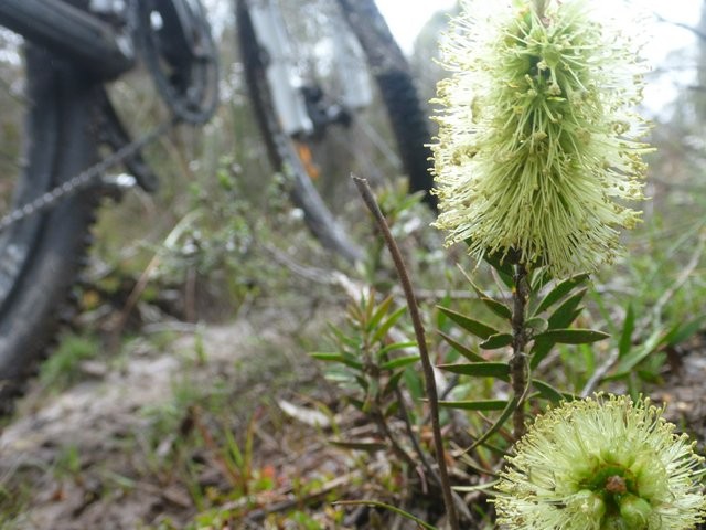
Key Statistics
- State Forest
- Local Government
- Conservation Area
Location
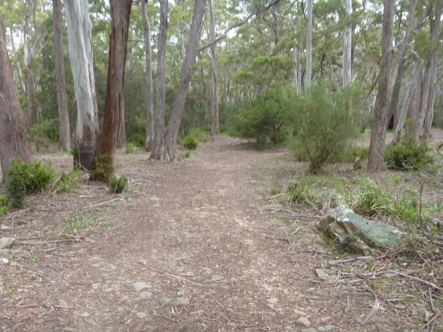
This 20km circuit will interest both those who like to leisurely explore new areas on their bike as well as those who like a bit of adventure and challenge. The circuit follows old 4wd tracks and is pretty flat the whole way around. Any reasonably fit cyclist could tackle the ride, but there's a few tricky sections (and lots of mud) so be careful on this one. A great ride for late summer when things have dried out a bit.
GETTING THERE
If you don't know where Tooms Lake is, then imagine a line on a map between Oatlands and Coles Bay and it's about smack bang in the middle of that line. This puts it a long way from anywhere, and you'll need to give yourself a couple of hours to get there from either Hobart or Launceston.
If coming from anywhere south of Oatlands, head up the Midlands Highway towards, and then past, Oatlands taking an odometer reading as you pass the northern entrance into Oatlands (but don't turn into Oatlands - continue up the highway). About 3.7kms from the Northern Entrance look out for the junction onto the C307 (York Plains Road) signed to York Plains/Lemont and Tooms Lake.
Reset your odometer here as you turn right onto this road and follow it for 18.8km (the first 12.5kms are bitumen but after that it's all gravel road) until you come to another junction. Turn left here onto Stonehouse Road (Signed C306 to Tooms Lake).
29.3kms from where you turned onto York Plains Road you will come to a significant unsigned junction. Take the left fork here (the right fork leads to an alternative entrance and eventually Little Swanport on the East Coast). Another kilometre later you will come to the junction with the C305 (Tooms lake Road) to Ross. Go right again here.
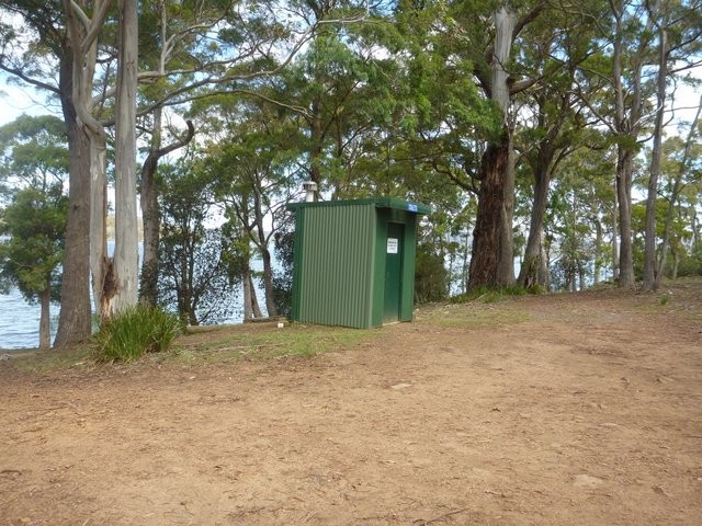
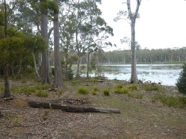
Continue 7kms past here and you will see some shacks on your right as you come up to the lake. Continue along the road and you will see a "Public Toilet" sign pointing past the boat ramp, follow this sign and park somewhere near the toilet to start the ride.
If coming from the North, head down the Midlands highway to Ross and then head into the Ross township. Drive through the town until you come to the Give Way junction with Bridge Road where you usually turn right back onto the Highway (the Pub will be on your left). To get to Tooms Lake, turn left at this junction and follow this road (C305 Tooms lake Road) all the way to the Lake (approximately 41kms).
Finally, an option for those on the East Coast, is that you can head up to Tooms Lake via McKays Road which runs between Lake Leake Road and Little Swanport. This was a very rough gravel road last time I went down it (October 2021). To come in from this direction, head to Little Swanport and make your way onto Bresnehans Road. Follow this for 13kms (it becomes McKays Road) where you will come to a major junction in the middle of nowhere. Turn left at this junction and drive another 1.9kms until you see a short road heading off on your right. Turn up this and drive to the yellow gate 150metres in front of you. You can park here and then cycle around the quarry and into the Reserve. It's about 3kms to the lake and you'll need to follow the pink line on the map.
You could also continue along the road and come into Tooms Lake the normal way which is probably recommended.
FACILITIES
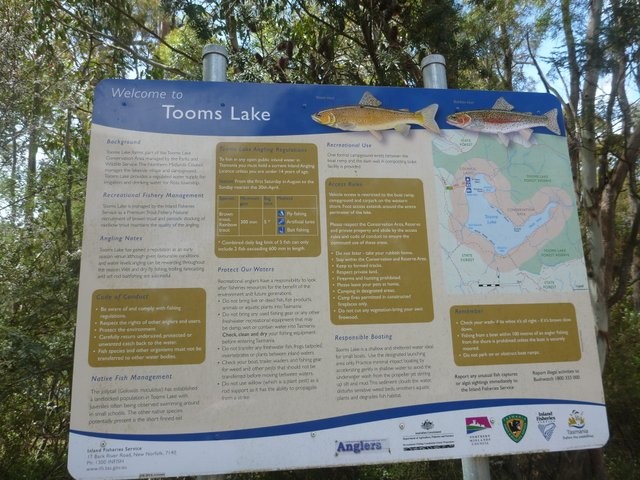
There's a single basic toilet at the lake which is relatively new (2021). There are facilities at both Ross and Oatlands.
ROUTE OPTIONS
You could ride this circuit in either direction, but I would recommend riding it in a clockwise direction.
As shown on the map, there are a number of forestry tracks off the southern side of the lake. Some of these are quite nice or would make good 'wet weather' alternatives.
There is a further network of forestry roads running off the south of the lake which I haven't shown on the map, but if you go to Google Earth or www.thelist.tas.gov.au you can find them and go exploring.
WARNINGS
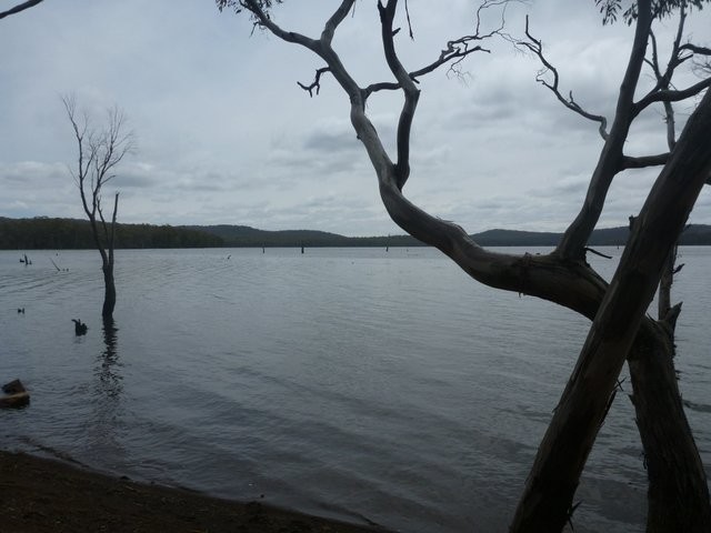
This is a remote ride, and whilst there may be fisherman out on the lake that you can flag down, don't rely on other users coming along anytime soon. Carry a proper first aid kit (snake bites and cuts are real possibilities) and follow all normal safety precautions for a remote area ride.
I seemed to have some reception (Telstra) around much of the route based on the dings I kept hearing from my backpack, but I wouldn't rely on it.
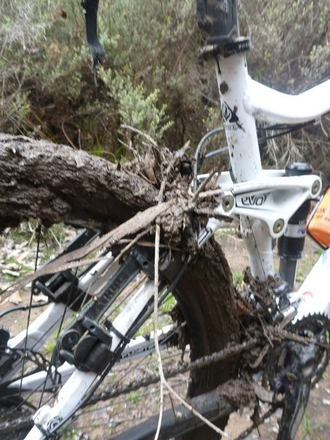
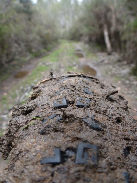
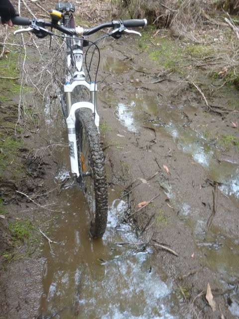
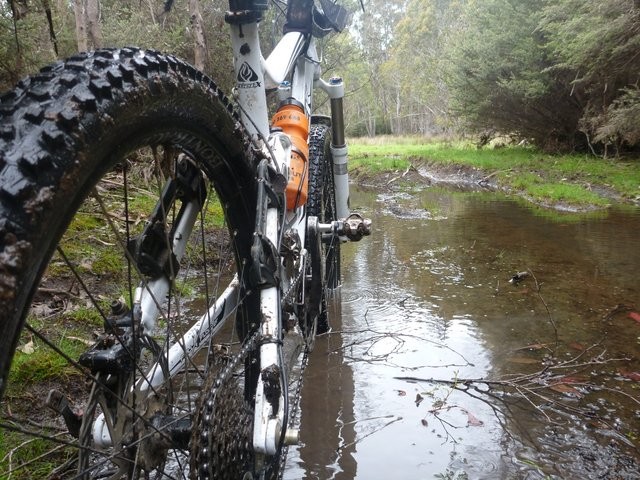
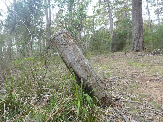
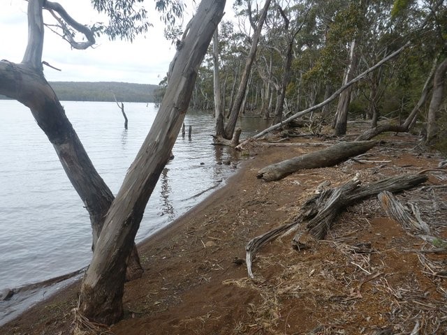
There's lots of sticks and tree fall on this track, rivers to cross, it can be a very cold and windy area, and if it's wet, the mud either sticks like glue or is as slippery as ice. Treat this ride with the respect it deserves.
ROUTE DETAILS
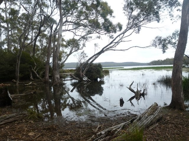
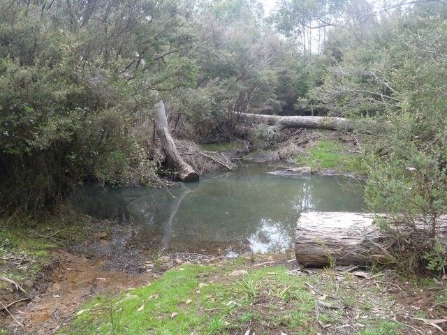
From the car park either head along the lake and make your way over the small dam (noting it is scenic but pretty tricky and could easily lead to a nasty fall) or the recommended safer route route is to head out onto the road and continue on along around the lake for about 100 metres where the road turns heads down to the left and into a turnaround area where there is an old ford now closed to vehicular traffic.
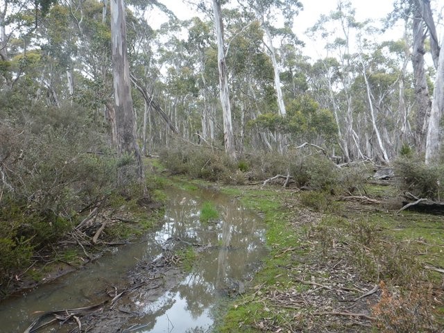
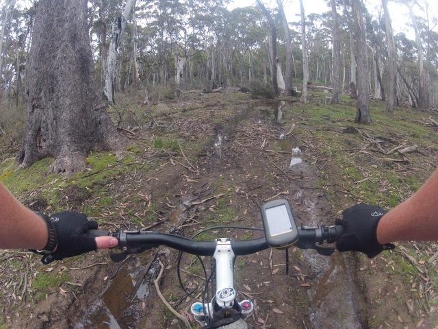
Depending on the lake level this may be dry, but more likely you'll get wet feet here. Once across the spillway continue to follow the track around the lake. There are a few alternate spurs and tracks over the next few hundred metres, but you'll soon find yourself on a clear and distinct track heading around the lake and from here on in the navigation is pretty easy, with the main challenges being lots of little detours around submerged areas or large tree falls.
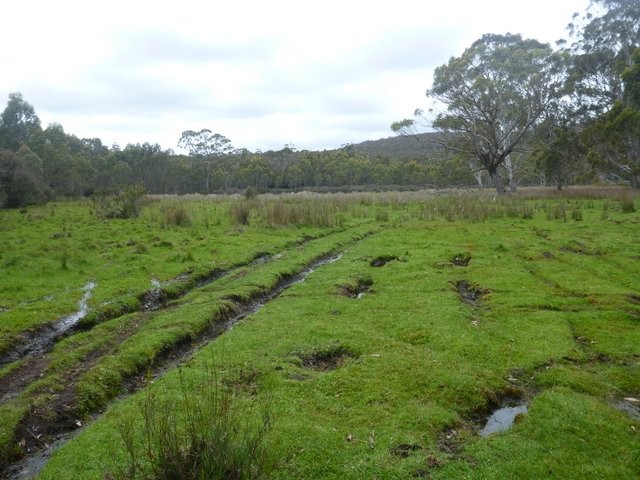
Approximately 7kms from the start (depending on how many little detours you take down to the lake) you will come to an overgrown section of the track (at least it was when I was there in March 2021) where it looks like vehicles have headed out onto the lake shore and continued that way. Unfortunately (unless you want to get very wet) that is a dead end and you do need to push through this short section of scrubby track (only a hundred metres or so) and then continue on to cross Jimmy's Creek (7.3km) which depending on the season may or may not be wet. Just past this creek you will emerge into a lovely green meadow. There is no clear track here, and you sort of need to just imagine you want to circle around the lake and head across the meadow to your right. You will almost immediately cross a second smaller stream running through the meadow and then head into a lightly bushed area that looks like it's been used for camping. At the back of this area you will see the track heading back into the bush. I've done this twice without a GPS and both times found the track pretty easily.
Other than a few short spurs down onto the lake's edge (most worth checking out) the next major intersection is 11.7kms from the start when you come out onto a fairly major T junction. Most riders will want to go right here down towards the lake edge.
This is also the point where those coming in from the Little Swanport direction will come onto the trail. It's a 3.4km ride on the most obvious route out to where you'd park your car.
If you've found that you've been slogging it out in wet muddy conditions the whole way to this point, you may want to consider turning left at this junction and riding a kilometre up this road until you come to another junction. If you turn right at this junction you can then follow a nice dry track 3.6kms parallel to the lakes edge and skip one of the muddiest (though fun and scenic) sections of the trail. If you do this you will rejoin the main track 14.7kms from the start.
However for most cyclists, you'll want to turn right at the 11.7km point and head about 100 metres down towards the lakes edge looking out for the trail which takes off again on your left about 50 metres before you get to the actual lakes edge at Watch House Bay (worth a quick visit).
The next 1.5kms of track heads through the Swanshaven Swamp and is perhaps the muddiest section of the trail. My bike disappeared into puddles over its wheels on one bit of this and the mud was like slippery ice and super glue at the same time. Just before you get to this section there is a track that now heads down to the shoreline, and if you follow your nose on this track you will miss most of the worst sections of mud (this is what I did when I rode the trail in March 2021) entering at the junction mentioned in the next paragraph.
13.4kms from the start you will however come out at a bit of a junction (the right hand fork heads down to a dead end by the lake) where you'll turn left and continue another 1.3kms (14.7kms from the start) to where the "dry route option" mentioned above rejoins the track on your left.
Another 200 metres past this junction (14.9kms from the start) you'll come to a significant junction where you want to turn right (going straight ahead will bring you out onto a road). You're now on pretty dry and open trails.
15.9kms from the start you'll come to another junction where you should turn right and follow the track down the hill towards the lake (You can take the left fork (or really straight ahead) and this will take you back out to the access road to Tooms Lake which you can follow back to your car).
You will come to one last junction about 350metres down this hill which is really just a dry detour around another very marshy section, so take the left junction, rather than going straight ahead, although either way you will come out onto the lakes shore (16.8kms from the start) and you just follow the track along the foreshore and then around behind the shacks where it comes back out onto Tooms Lake Road (18.6kms from the start).
Turn right and it's about 500 metres back along the road to your car (19.2kms in total).
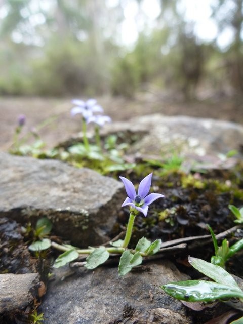
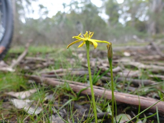
Photos
Attachments
-
File DescriptionFile SizeFile TypeDownloads
-
Lake Leake and Tooms Lake - Anglers Access (Ed. 5)
1 MB 22
22 -
IFS Lake Leake Tooms Brochure
1 MB35 -
Tooms Lake GPS (gpx)
123 KBgpx63 -
Tooms Lake - Google Earth (kml)
47 KBkml55
Map
Editor review
Review

User reviews
Resources
Other Resources
Blogs, Articles etc.
-
{{#owner}}
-
{{#url}}
{{#avatarSrc}}
{{name}} {{/url}} {{^url}} {{#avatar}} {{& avatar}} {{/avatar}} {{name}} {{/url}} - {{/owner}} {{#created}}
- {{created}} {{/created}}