- MTB
- Bellingham to Bridport (St Albans Bay) 4WD track
Bellingham to Bridport (St Albans Bay) 4WD track
Hot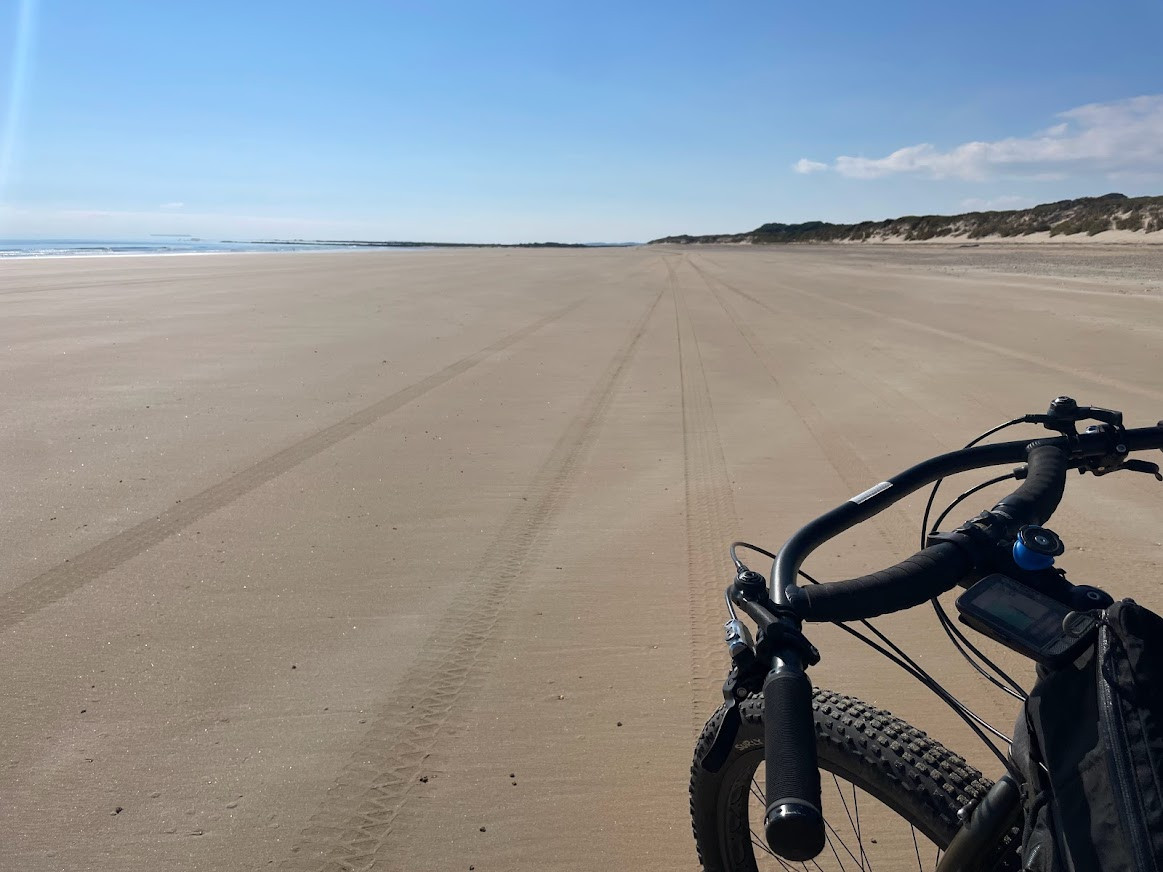
Key Statistics
- Conservation Area
The core of this route is the coastal 4WD track from Bellingham to Bridport and if you can arrange a shuttle then that may is probably the best way to enjoy this ride on a bike. Taking in amazing beaches, some challenging dunes, a little bit of singletrack and a section of highway this is quite a long ride, and one that is best enjoyed with a cruising mindset. A great choice for those looking for something different and away from groomed mountain bike trails.
GETTING THERE
If coming up from the south or north west, then there are a few options for getting to the start point and I'd recommend just putting "Bellingham" into whatever mapping App you use and follow the route of your choice to where you turn off Bridport Road onto Bellingham Road (note you don;t need to drive all the way to Bellingham). You'll see a large pull off area on your left when you turn off onto Bellingham Road where you can pull over and start the ride. If you want some guidance, I can recommend on route choice, the drive up from Launceston through Lilydale, Lebrina and then turning off and travelling through Pipers Brook. It's not the fastest route, but it is a nice drive.
You can just as easily start this route at Bridport, or at either end of the 4WD track (there are car parks at both ends). I just chose here as it was the least amount of doubling back in the car.
ROUTE OPTIONS
You can start this ride from anywhere on the circuit that takes your fancy and you could ride it in either direction. If you are able to arrange being dropped at the car park near Bellingham (noting the track actually starts a few kilometres away from Bellingham) then this could make a lovely shorter ride just to Bridport (approx 35km) and you won't be missing out on a lot by not riding back to Bellingham along the highway.
You could also just do an out and back on the 4WD track, but you'd need to push through the dunes on East Sandy Point twice plus time the tides in both directions, so I wouldn't necessarily recommend this option.
WARNINGS
To get the best out of this ride, you really need to time it so you are on the beach around low tide or else you could find yourself doing a lot of pushing through soft sand. I'd recommend using one of the many Apps out there to check the tide near St Albans Bay on your planned riding day (I used willyweather and the BOM App for my trip and they worked well).
Both times I've been out in this area, there have been a lot of 4WD's around and I've had reasonable mobile reception (Telstra), but that's no guarantee you will, so make sure you have everything you need to look after yourself in case of an accident and do all the usual safety stuff of lettin someone know where you are going, when you'll check in etc. Also be aware that some of the track sections crossing the East Sandy Cape are pretty narrow and the many 4WD's, quadbikes and motorbikes coming through won't be expecting to see a cyclist pushing their bike as they come around a blind corner, so if you hear them coming (and you will) it can pay to get yourself out of their way with time to spare.
If riding the full circuit (including the 20km section along Bridport Road), I'd highly recommend having a rear flashing light and high-vis clothing.
ROUTE DESCRIPTION
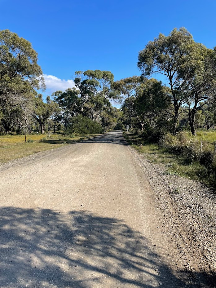
Heading off from your car towards Bellingham, the first 4.2kms are along a quiet, undulating bitumen road which is a great way to warm up. At about 4.2kms from where you parked your car you want to turn right onto a gravel road (Gees Marsh Road). This road turns sharply to the left at about 5.1kms and then at about 6.3kms from the start you will come out into the 4WD track car parking area set up to let cars inflate/deflate their tyres. The 4WD track itself starts just past the car park on your right and is well signed.
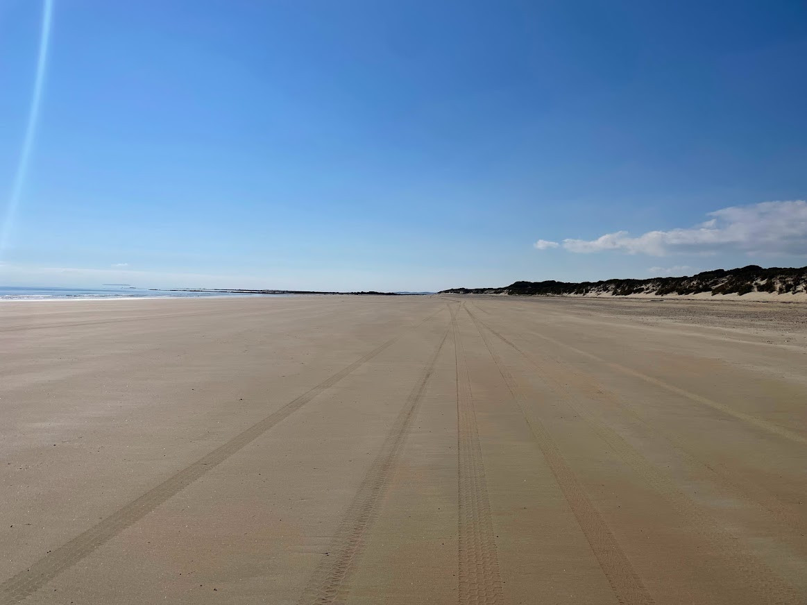
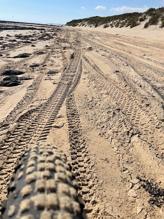
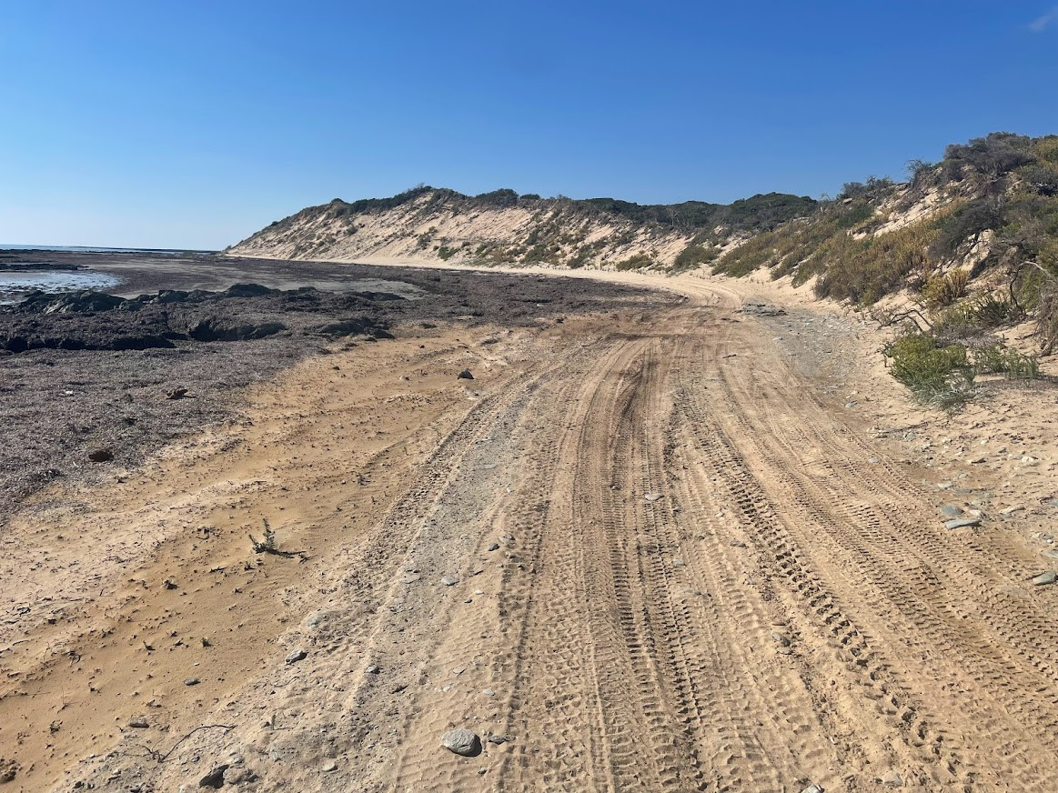
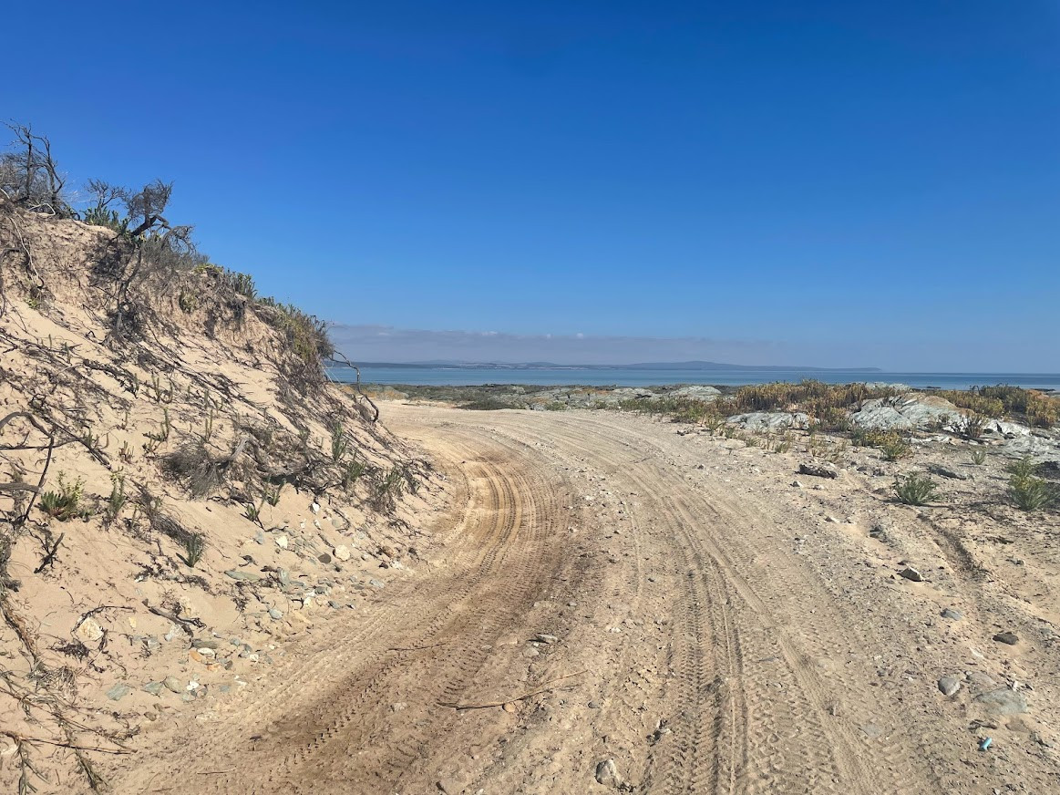
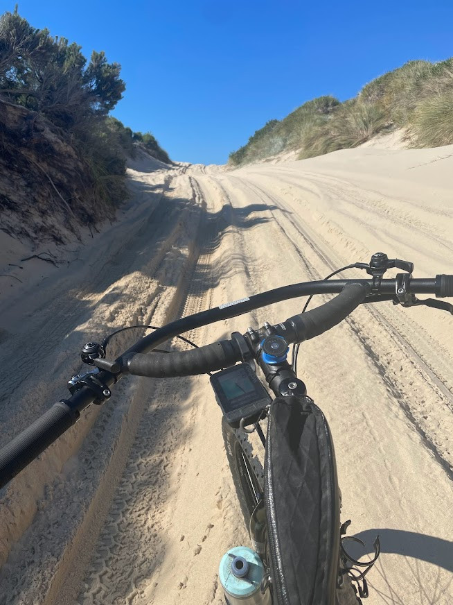
The next 600 metres down to the beach can be a bit soft and rough depending on the traffic that has been through, but when you get down onto the beach (6.9kms from the start) you will have that behind you and you should find yourself on nice hard packed sand that is magic to ride.
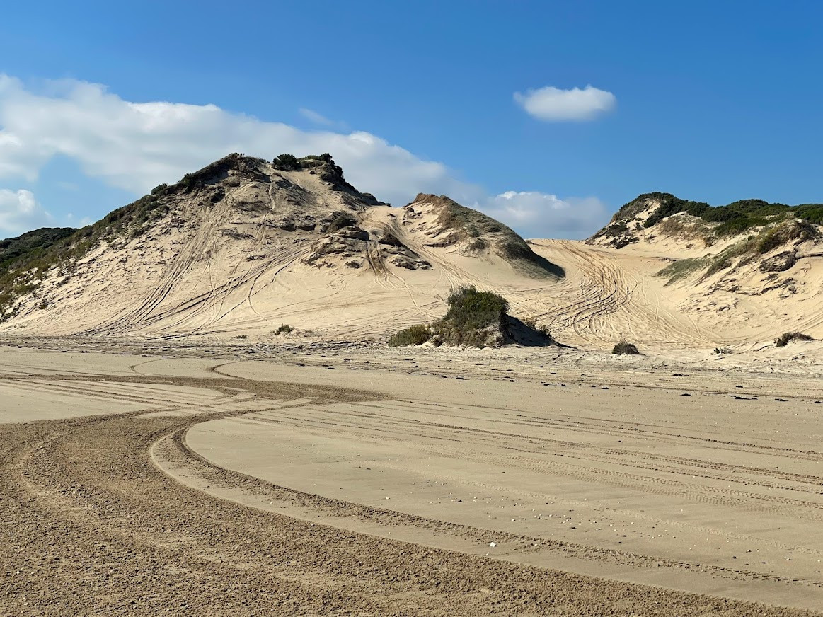
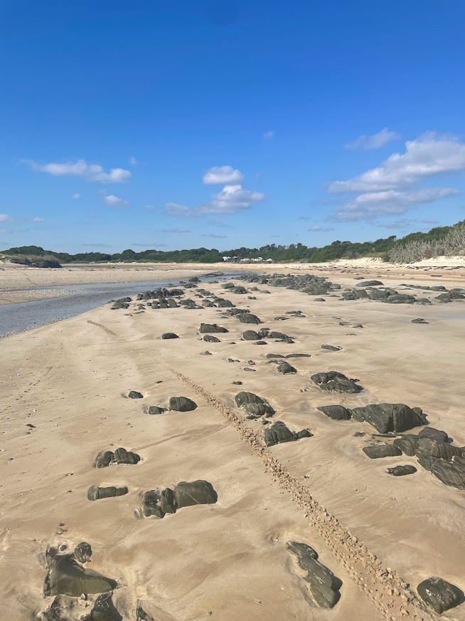
From here it is basically a matter of turning right and riding along the beach wherever seems best to you. You will be forced towards the top of the beach (and the softer sand) as you head around the various headlands, but I managed to ride the whole way. There were also sections along the where I was really searching for some harder sand to ride on, but just in the sense that the top bit was a bit soft and slowed me down, not that it stopped me. The crossing of Little Pipers River (Fordington) is about 9.3kms into the route, and then at around 17.6kms and 19kms into the route you should see some 4WD tracks cutting across West Sandy Point which are alternates if you either can't get around the point due to a high tide, or if if you are doing and out and back and want a bit of variety. Be aware that the first route at 17.6km is a very soft, sandy track and you will end up pushing most of it. The second alternate at 19km is more ridable.
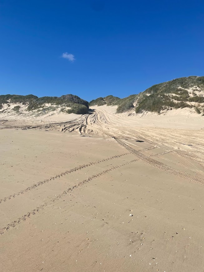
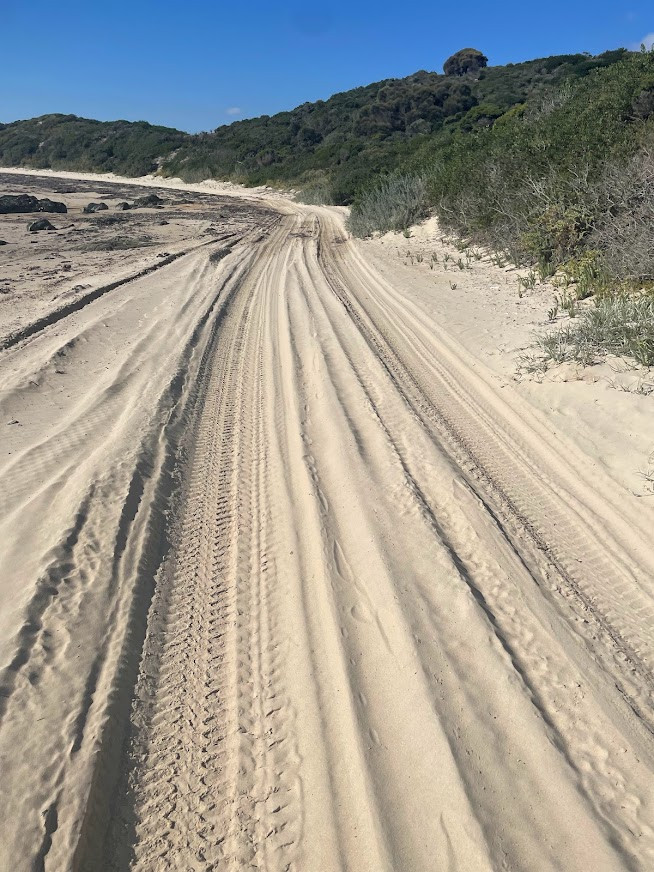
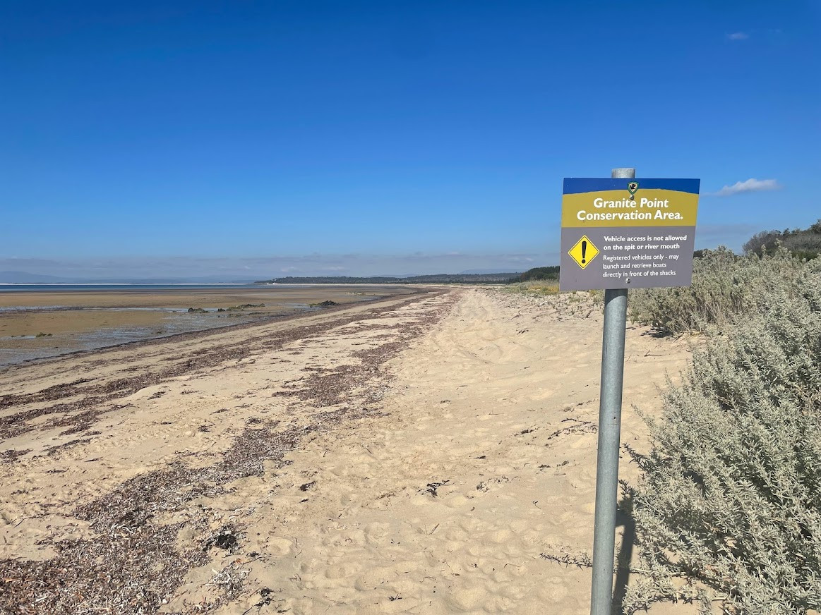
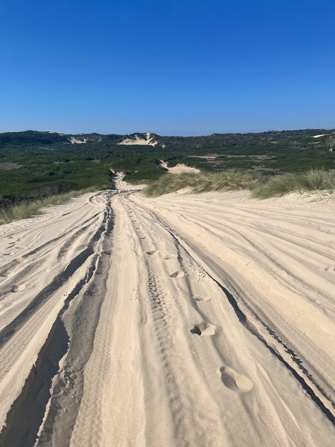
Assuming you head around the headland, you will come to the beach exit point at around 24.5kms into the trip at a well signed point (there are signs on the beach prohibiting vehicles going beyond this point and all the vehicle tracks clearly head of up a dune). From here you just need to settle in for a 3km walk to the other side of the peninsula, though lighter riders, or those with fatter low pressure tyres should be able to ride at least the downhill sections of this route). At the other side, you will drop down onto Lades Beach (27.5 kms) very briefly (about 400 metres) riding in front of a couple of private beach houses, before following the signed tracks back up behind the beach and out onto Sandy Point Road. You will pass through the car park at this end of the track at around 28.6 kilometres from the start.
Just follow the gravel road from here, noting there is one turn to the right at about 31.9 kilometres, and then you should come onto the bitumen road at about 33.2kms, which is about the same time that you will start the short climb up the back of the hills towards Bridport.
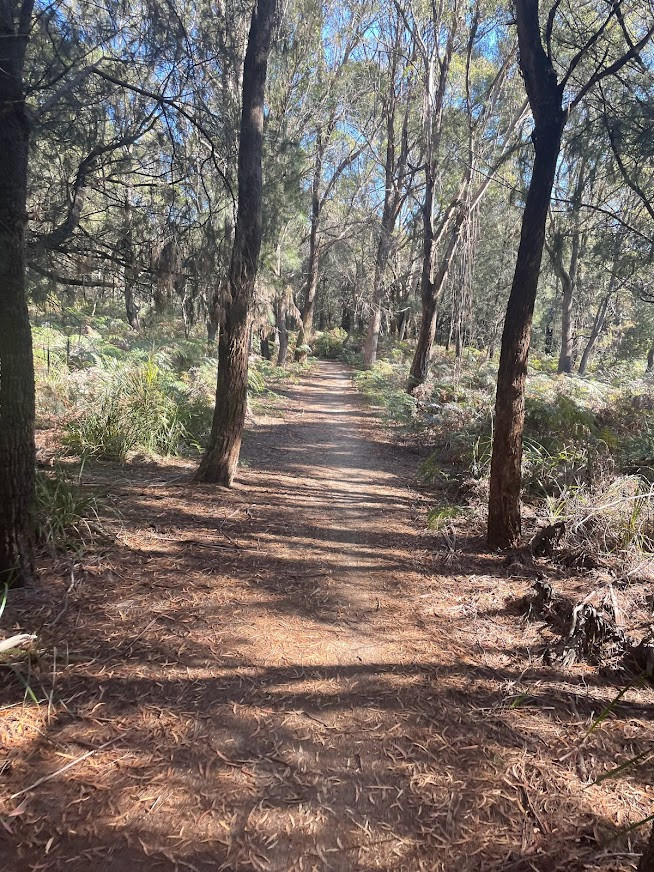
As you come to the crest of the climb (Approx 34.9kms) you will see a car park on your right, with a track heading off into the bush. While you could juts go straight ahead and down into Bridport, I highly recommend, turning right onto this lovely track and following it for aout 4.4kms down to the Brid River mouth. This track is mainly flat or downhill and is very easy to follow. It does cross a couple of roads, and at about kilometre 38.1 you will come out at the bottom of a short road, you just need to head up this road for about 100 metres until you will again see the track heading off to your right. There is also a bridge soon after this point where you will need to carry you bike down some steps, but it should all be manageable.
Once you come out onto the Main Road at the Brid River, you could just head right and start going back to the car, but I'd recommend heading left across the bridge then crossing the road onto the foreshore path and following that for about a kilometre which will bring you to an area with lots of seating and playgrounds. There are several shops and cafes just above here if you want to pop out onto the road and get some lunch, drink and have a break before retracing your steps back to the Brid River bridge where you came out (41.6km).
200 meters further along Main Road you should take the first right onto Ada Street (41.8 kms) and follow this to its end (42.8kms) where it comes out onto Bridport Road (this road is just a quieter shortcut which keeps you off the main road for a bit longer which is why I recommend it). Turn right onto Bridport Road, and it pretty much smack on 20kms back to your car from this point (62.7kms). The road has got quite a few climbs, but none of them are too steep and there was usually a decent shoulder or at least I never really felt uncomfortable riding back to the car, though I wouldn't do the ride with inexperience or younger cyclists.
Photos
Map
Editor review
Review

User reviews
Resources
Official Site
Blogs, Articles etc.
-
{{#owner}}
-
{{#url}}
{{#avatarSrc}}
{{name}} {{/url}} {{^url}} {{#avatar}} {{& avatar}} {{/avatar}} {{name}} {{/url}} - {{/owner}} {{#created}}
- {{created}} {{/created}}