- Road Rides
- Hobart Airport Cycling Route
Hobart Airport Cycling Route
Hot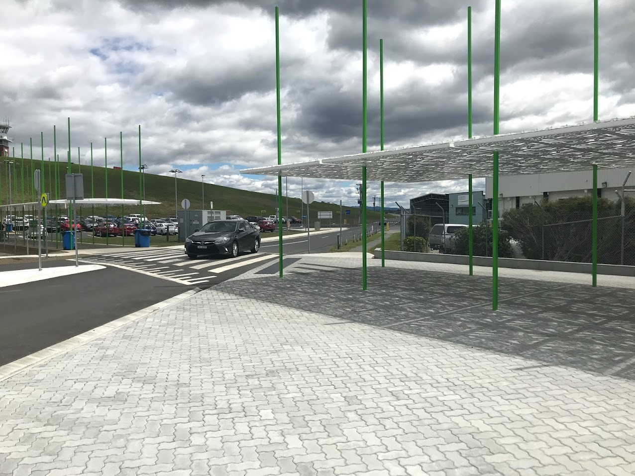
Key Statistics
- Not specified
Overview
There's several ways to get to and from the Hobart Airport from the Hobart CBD, however this route is in my opinion the best compromise between distance, climb, traffic volume and complexity. It basically follows roads that run parallel to the main A3 highway. The other advantage of this route is that it passes several accommodation providers and the nearest camping / biking store to the airport.
The main route described below is just over 21km , and if you know your way it can be done in about 45mins to 1 hour, however allow up to an hour and a half if you've got a fully loaded mountain bike and are prone to getting lost.
At the Airport
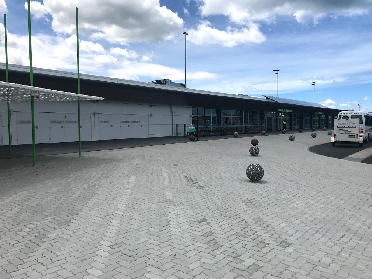
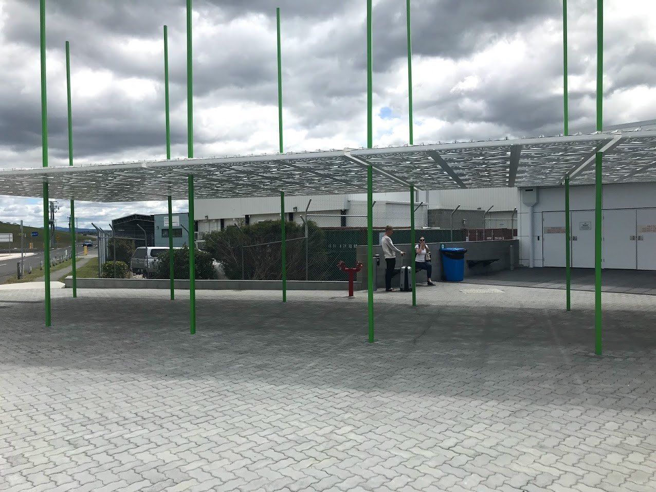
There's plenty of room outside the airport building to find a quiet corner to put your bike together or take it apart. There are not however any tools or facilities to do so. I'd recommend exiting the airport building and turning right and walking down to the end of the building. There is a quiet corner at the end of the building where you can sort yourself out and the recommended exit is then straight in front of you (see photos).
Alternatives to Riding
Other options into Hobart are Tasmanian Redline coaches or a taxi.The Redline Airport coach will drop you at or near your accommodation if it's in the CBD, and last time I checked it was $15 each way plus an extra $7 to carry a bike.Last time I caught a taxi to the airport it cost me about $50 from the CBD so if there are 2 or more of you (and they can fit your bike) this might be a more flexible option.
Can I just cycle down the highway?
It is legal to take the direct (but dangerous) route along the A3 highway, and yes it is the quickest and easiest way, however there are several high speed exit and entry ramps along this route, and you're in commuter traffic which isn't usually that sympathetic to cyclists, so really avoid this route if you can.Don't cycle directly across the Tasman Bridge. It is now illegal to do so, and it's also near suicide. If cycling from the airport there is a signed exit point for cyclists to get off the road and cycle alongside the shared (and narrow) pedestrian cycleway.If coming from the Hobart CBD follow the cycleway out from Hobart and just follow the signs over the bridge. It's best to cross on the downriver side of the bridge.Be careful going across the bridge as it is narrow, and can be slippery when wet. Also be polite to other cyclists and pedestrians. All the locals are used to squeezing past each other and there's no established rules about who gives way to who, just be nice, ask if you can get past if coming up behind someone, and say thanks when people let you past. In short, be a decent human being and you won't go wrong.
Recommended Cycling Route (Airport to Hobart)
Note: The exit from the airport changed in early 2017 as part of the runway extension work. so the GPS route out of the airport doesn't show the first few hundred metre correctly.
The main exit from the airport if now a bit nasty on a bike due to narrow shoulders, lots of traffic and fences that have been constructed to stop people parking on the side of the road. To avoid this, head down to the North Western end of the airport building (so turn right as you exit the building - you will be going against the vehicle traffic) and look for the road that heads out alongside the airport (see photos for visual reference). There's only one road out and you'll pass Toll's depot on your right and the car rental sign on your left as soon as you leave the building. You should also have the air traffic control tower in front of you to the left and the runway on your right.
Follow this road alongside the runway and then past Tasmanian Gourmet Seafoods (which I can recommend for some nice seafood) until about 1.1km from the airport where the road turns sharp left in to Llanherne Drive (signposted to the A3 Tasman Highway). For those looking for accommodation near the airport, there is a Big Four Tourist Park which has cabins and camping sites and the Hobart Airport Hotel, both on your right. I can't vouch for either having had no need to stay there. There is also a BP Service Station (which has a Subway outlet) on your right as you get near the second roundabout at the end of this short (400m) road.
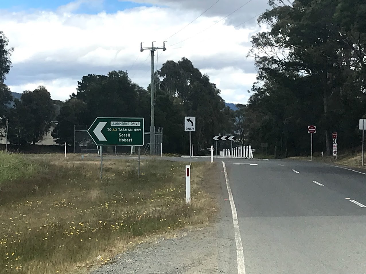
At the roundabout at the end of Llanherne Drive you need go right (second exit) towards Hobart. Be aware you are now back on the main exit from the airport and this section can be really busy. It is, however, only another 300 metres to a large and busy roundabout up the road (This roundabout is scheduled to be upgraded to an overpass in 2018-19). Those wanting to follow the highway into the city can just turn left and follow the A3 highway towards Hobart at this roundabout. However, the recommended route is to head straight through the roundabout (be careful) and follow the exit towards Cambridge.
This next section of road has an on road cycle lane (of sorts). As you cycle along this road, you'll see Cambridge aerodrome on your right and a kilometre further along you'll see Cambridge Park Shopping Complex on your left. If you need any cycle gear, outdoor gear or stove fuel then this if your best chance of picking them up. There is an Anaconda Outlet which stocks a range of bike and outdoor gear, and even has a repair shop which might be able to help you out in an emergency. Anaconda stocks many stove fuels.You access the Shopping Complex via a roundabout 3.9kms from the airport. It's about parallel to the Anaconda store, and you won't miss the Anaconda Sign. If you don't need any of these things, then just continue straight ahead towards Cambridge.
Continue straight ahead through a second more significant roundabout 4.7kms from the airport where the bike lane ends. Take the B31 exit towards Cambridge / Richmond.6.0kms from the airport (1.3kms from the roundabout) you will see a turn off to Richmond on your right, ignore this and continue straight ahead. There's a small takeaway shop on your left just before this turn off if you need any snacks.The other main accommodation choice close to the airport Barilla Holiday Park is a few hundred metres down the road towards Richmond, however to be honest it is an inconvenient distance from both the airport and Hobart to really be worth considering. It does have a mini-golf course though if that takes your fancy.The next section of road has virtually no shoulder, but it is a fairly common cycling route so motorists are generally pretty good. You'll pass an old pub (7.0kms from airport) on your right (mentioned again in case you need emergency accommodation) and then at 8.2kms from the airport, the road turns left under the highway, and starts a little bit of a climb up towards Mt Rumney / Mornington. Ignore the turn off onto the highway (signed to Hobart) immediately after heading under the underpass and continue up the B28 to Mt Rumney.
Head up over the little hill (crest at 10.1km) and then back down the other side towards Mornington, ignoring turn offs to Mt Rumney and Rokeby on the way. You will come to another major roundabout 12.0kms from the airport.
This roundabout has a cyclist / pedestrian route on the outside of it and I never thought I'd say this, but I'd recommend jumping off onto the concrete cycle path on your left just before you enter the roundabout and use this to go around the roundabout. You basically want to follow this path around the roundabout and then you'll see it heads off just before going under some power lines (if it helps, as you approach the roundabout, the way you will leave is at about your 2 o'clock).This path drops you out onto the end of a street (Bligh Street) which continues in the direction you were heading before entering the roundabout.Follow this street. You will go through a few roundabouts, and after about 2.3kms you'll come to some traffic lights next to a KFC (14.6km from airport). Continue straight ahead through these lights into a short bus mall.You are now entering the Eastlands Shopping Complex.
There is both a Coles and Woolworths in the shops to your right, and there are also several banks and ATMs here if you need to get some cash before heading into the CBD. There is now a Woolworths Supermarket in the Hobart CBD, so most cyclists will be able to just continue into the city.Exit the bus mall and continue straight ahead 200 metres to a roundabout just past a movie cinema complex on your left.
You've got a few options here. You can just continue straight ahead, crossing a large road just after the roundabout and then follow the road you're on until it comes to an end at a roundabout by the water (another few hundred metres). You'll see the Clarence Foreshore Trail running along the waters edge at this roundabout, and you can turn right onto this and (if you're not in a rush) just follow it all the way around the shoreline to the bridge. Most cyclist however exit the cycleway about 400 metres after you got onto it (just past the cricket nets where the track branches) coming out into a roundabout. You can then just ride straight up the short hill in front of you, then turn right (150 metres from the roundabout) at the top of this hill and then follow this road to the end which will put you at the T junction between Bastick Street and Riawena Road mentioned below.
The other option from the roundabout at the movie complex (and the route shown on the map) is to turn right into the carpark at this roundabout. Continue straight ahead through the car park right next to the main shopping complex which will be on your right. Just behind the bottle shop you need to cycle into a little car park straight in front of you and you'll see a pedestrian overpass at the end of this car park. That's where you're going to get across a busy road. Cross over this overpass (it is cyclable with no steps) which will drop you into a small park on the other side of the road. Continue up the path that runs through the park in the direction you've been heading (basically up the hill towards some pine trees). After another 200 metres you emerge at a T junction where Bastick Street comes into Riawena Road. Cross Bastick street and continue up along Riawena Road in the direction you've been heading (don't worry, the crest is only 50 metres away and as you crest this hill, you will see the bridge in front of you).
Continue along Riawena road which runs back down the hill and will drop you at the entrance onto the bridge. This bridge is narrow, and with high winds can be spooky for fully loaded cyclists.Once across the bridge, you just follow the path which loops back on itself momentarily, as it takes you back across the road towards the river and onto the Intercity Cycleway.
This cycleway will take you right to the Hobart Docks. For those heading out towards Moonah or Glenorchy, the cycleway branches under the bridge and if you cross the railway and head left you will be heading out this way.The cycleway actually ends just before the CBD. When you drop out onto a small road at the end of the cycleway.You will see a red brick building to your left as you emerge from the cycleway. This buildings contains public toilets in case you're in need before beginning the search for accommodation etc.
Otherwise cross the road and continue on the obvious concrete path which will be just to your right as you emerge from the cycleway. The cycleway is well signed (it has a cyclist painted on it) and will quickly drop you onto the pavement running alongside the highway. Just follow this and you'll head down the hill and be dropped out at the Hobart Docks.
Continue on along between the docks and the road (to your right) until you come to a road (Argyle Street) at the end of the Docks. If you cross this road and continue up to the end of the next block (corner Davey and Elizabeth Streets) you will be at the main Visitor Information Centre which will be able to help you with accommodation from here. Turning right here and continuing up Elizabeth Street will drop you into the centre of the CBD (Elizabeth Street Mall, about 3 blocks away).
Quick Guide to Hobart
If looking for bike and camping shops, you can find Bike Ride just to the right (on Liverpool Street) at the far end of the Elizabeth Street Mall (Liverpool Street) or continue up Elizabeth Street and on your right in the first block you will find Macpac and a Mountain Designs store. Just across from Mountain Designs is the well stocked Mountain Creek Outdoors Camping Store. Continue on up to the next block and you will find a Kathmandu store, the Tasmanian Map Centre (best collection of maps and guidebooks in Hobart) and on the block after that you will find Ken Self Cycles. If between that lot they can't look after you, my advice is to get back on a plane and go home.
If looking for free internet access, turn left up Bathurst Street at the Mountain Designs Store (push you bike up the pavement as you'll be going against the flow of traffic) and at the end of the block (Murray Street) is the State Library of Tasmania which offers free wifi and internet access and has a bike rack in a nice open area just outside the front doors. You can also access 30 minutes of free wifi at any of these free wifi spots.Unfortunately the only secure bike parking in the Hobart CBD is set up for commuters, not travellers.There is plenty of accommodation of all styles (except camping) in Hobart.
Recommended Cycling Route (Hobart to Airport)
The route out from Hobart to the Airport is the same as the way into town, however it is a lot easier to follow in this direction.
Once you've got down onto the Hobart Docks, just follow the Intercity Bike Path out to the Tasman Bridge and then cross over on the downriver (city) side of the bridge. At the end of the bridge, the track exits to a road on your right. Just follow the road in front of you (Riawena Road) up the hill and over the crest.
As you head down the other side of the hill (50 metres from the crest) slow down and exit onto the pathway through the park on the downhill corner of the Bastick Street turnoff which is on your right.
Follow this path down to the overpass (which you'll see), cross over this and down through the car park (past the bottle shop on your right) and exit the car park at a roundabout. Turn left at this roundabout.You'll see the bus mall in front of you, so head through this and out the other side and then just keep following the road you are on (Bligh Street) right to the end (2.5kms from the bus mall). At the end of this street, jump onto the little concrete path for the last 100 metres out onto a busy roundabout. You want to exit this roundabout heading towards Mt Rumney / Cambridge, which is the exit basically heading in the same direction you were travelling when on Bligh Street. This route will take you up and over Mt Rumney and back down the other side.
Just as you get to the bottom of this hill, you will see a sign to Cambridge with an airport symbol on it ... you guessed it, from here you just keep following the airport symbols along the inward route described above, remembering that as you enter the airport (just after passing the BP) it is best to turn left at the roundabout and follow the back road for the last kilometre into the airport.
Photos
Map
User reviews
-
{{#owner}}
-
{{#url}}
{{#avatarSrc}}
{{name}} {{/url}} {{^url}} {{#avatar}} {{& avatar}} {{/avatar}} {{name}} {{/url}} - {{/owner}} {{#created}}
- {{created}} {{/created}}