- MTB
- Blue Tier Descent
Blue Tier Descent
Hot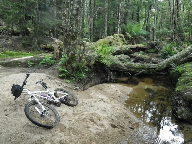
Key Statistics
- State Forest
One of the original mountain biking trails in the Blue Tier area (and now largely superceded by the new Blue Tier trail built as part of the Blue Derby network) you can ride the Blue Tier descent in several different ways, but at its heart the descent consists of 11km of old school technical trails connecting the deserted town of Poimena and Weldborough
The trail isn’t for the faint hearted, and inexperienced, but those who have a good level of riding skills will find some great technical riding amongst some beautiful forest and heathlands.
ROUTE OPTIONS
If you’ve only got the one car and are here for the day I’d recommend starting down at the Weldborough Pub and riding up the descent trail towards Poimena. It’s a hard climb in places, but you know once you’ve got to the top that you get to enjoy the ride down again ... well mostly.For those who are just here for the descent, then you can also access the trail from the top end at Poimena.
Poimena is also a good option for those who are a little less confident on the bike with the Wellington Creek Circuit offering some flatter, but still challenging riding.
With the opening of the Blue Derby Big Chook route in March 2016, you can now combine this excellent route into your return path to Weldborough.
GETTING THERE
Weldborough is about 120kms east of Launceston via Scottsdale (22kms east of Derby) on the A3 highway towards St Helens. It’s about a two hour drive (those roads are winding).From Hobart, you have the option of coming up the East Coast via St Helens, but going this way it’s closer to 300kms and a four hour drive. If coming up from Hobart you may hear about a secret 'shortcut' from Fingal over the Mathina Plains Road to Ringarooma, but trust me, it's hard and dusty driving to save around 10 minutes from a nearly 2 hour drive.
Either park near the pub or drive down the gravel road (Emu Road) on the St Helens side of the pub for about a kilometre and park near the gate where the actual off route section starts (Now well signed for the Big Chook ride).
If heading to Poimena, from the St Helens side the turn off to The Blue Tiers Forest Reserve on the C841 about 16km out of town, then follow your nose. It’s a steep drive towards the end. From the Weldborough pub end drive about 6.5km to the top of the pass, and turn left towards Lottah, at Lottah (8kms) turn left again and just keep driving up this road until you get to the Blue Tier Forest Reserve.
WHAT'S THERE
Weldborough Pub does decent meals and has some interesting ciders and beers. They've also got a great map of the area on their wall. They charge $10 per person for camping, or you can get a reasonable room (I personally can recommend).
If you can get up to Poimena you'll find picnic tables, free campsites (very exposed) and a basic drop toilet.
WARNINGS
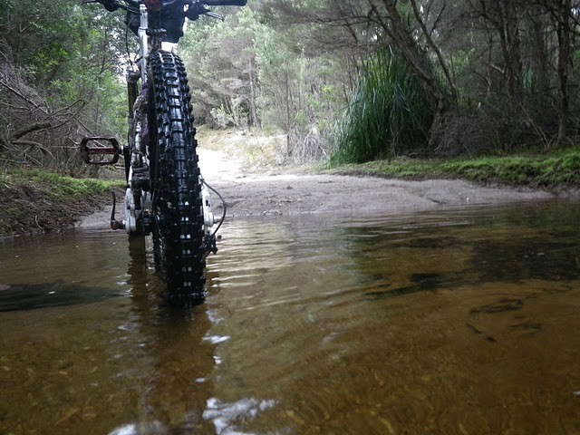
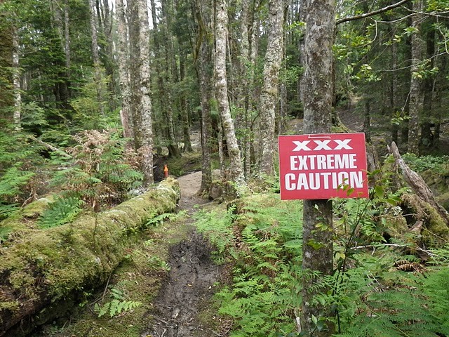
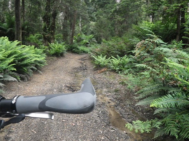
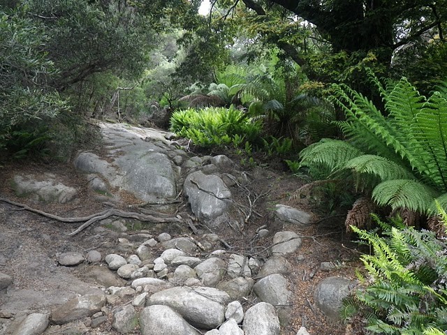
This is a steep technical ride and once you get past the turn off to the Big Chook descent (about 3kms up the trail) there aren't many other users around and mobile coverage is patchy at best. There are also several creek crossings to be wary of.The Blue Tier Descent (11kms each way)
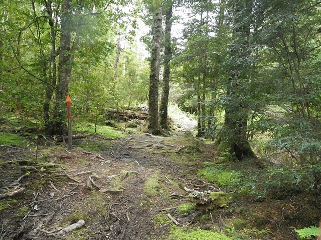
Starting from Weldborough, follow the gravel road towards the North. About a kilometre along the road, look out for the Blue Derby 'Big Chook" sign on the left side of the road, go through the gate, and continue along the track crossing a new bridge.
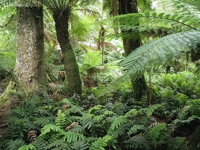
Over the next 3km you’ll climb about 250 metres as you follow an old trail up through lovely forest. The trail is quite pleasant now thanks to the Blue Derby trail work and the climb will be manageable by most fit riders. At the top of this climb you will see the signed turn off on your right onto the Big Chook single trail descent. This is the way to return on your way back.
You get a bit of reward for the climb for the next kilometre as you drop back down, head past a eucalyptus plantation on your left and reach a T-junction where you need to turn right (there used to be signs here, but apparently they are now gone). You’re at the bottom of the Descent and it’s time to get climbing.
NB. If you turn left at this T Junction, you will come out onto Frome Road (about 100 metres from the junction). This junction can be reached by 2WD vehicles and is an alternative access/exit point. There is also some very nice singletrack (RC Track) further down Frome's road.
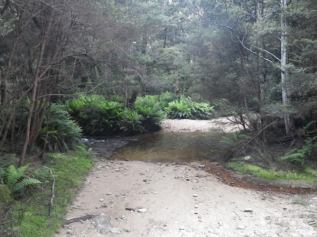
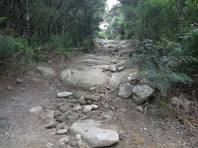
Continuing right up the Descent track, you will soon come to a track fork with the left fork crossing a substantial stream: time to get your feet wet. After a kilometre of flat, fairly easy riding from the junction, albeit with a few more creek crossings, the climbing begins, and you’ll gain another 220 metres in height over the next three kilometres. Most of the route is rideable for competent, fit riders, though there are a few spots where pushing is a good option.
At the 8.2km mark there is a detour to the left to Wyniford River Water Race. It didn’t excite me, but hey you’re there so why not have a look before continuing up to the top.
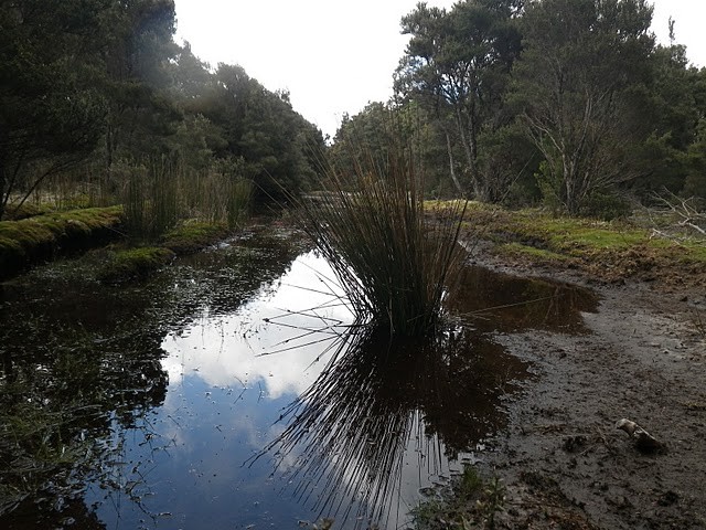
The final 1.5km is in more open country, with quite a few undulations, technical rocky sections and several major creek crossings, before you’ll finally cross over the new Blue Derby track before joining onto the Wellington Creek Track.
From here you can just turn around and begin the fun on the way down, or the recommended option is to continue clockwise around the Wellington Creek Track loop (8kms) before returning back down the Descent.
The only problem with this route is once you get to the bottom, you just want to turn around and head straight back up and do it again.
Wellington Creek Loop (7km circuit)
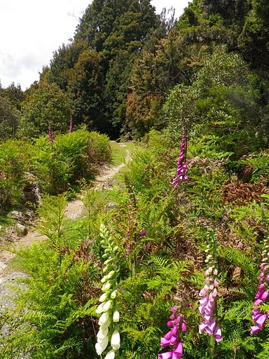
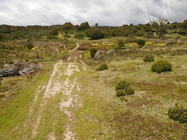
From the top of the Blue Tier Descent continue straight ahead along the gravel track. After a short section of forest, you’ll come out onto an open alpine area, where some fun riding is to be had over some small bridges and open tracks.
Approximately 2kms from the top of the descent, there’s a trail that heads off to the left which goes through the old township.Don’t be tempted to head through this way as it is pedestrian only, but do be tempted to do the circuit on foot once you drop out to the Blue Tier car park .Continue another 200 metres and you’ll see your return route heading off to the right, and another 200 metres you’ll come out at Blue Tier Reserve.
This is a great spot for a break, with picnic facilities and toilets available. This is also the starting point for those who have come in from the top.There’s free camping available here for those who like an open sky (and freezing winds) and there’s also a whole bunch of walks around and about, and some interesting historical interpretation for those who are that way inclined (like me).
When you've had your fill of this spot, head back to the alternate return route where you’ll see a walkers sign pointing the way you came and a bike sign pointing off on a less than promising track to the left.
NB. The Wellington Creek Trail has been designed for one way bike traffic (walkers go the other way) so go with the flow.
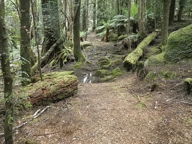
After a bit of a wet section, the track descends down through an open air, and past an old sawmill site with some interpretation before heading off into the myrtle forest.
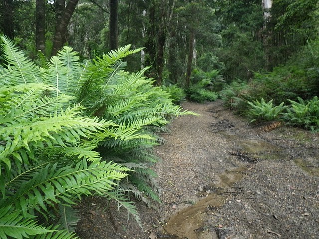
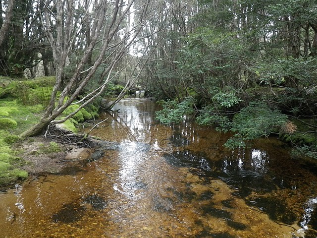
The next 2.5 kms back around to the top of the Descent is some custom built single track. It’s a good technical challenge, and ‘ll admit it was just a little too good for me, as I spent a lot of time getting bogged in soft spongy mud, slipping off roots and I had one nasty little fall off a bridge. Also beware of the drop into Wellington Creek itself, it’s not for the average cyclist.
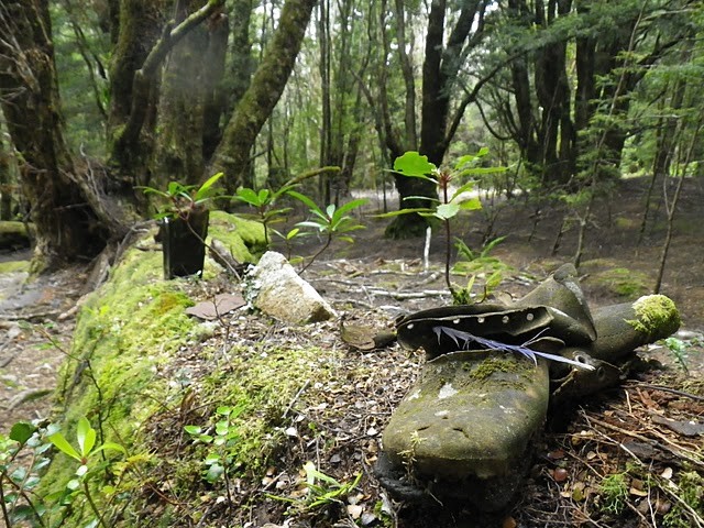
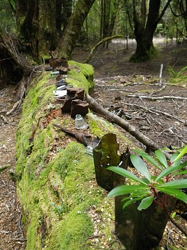
The creek itself is gorgeous (you've even got your own private beach, admittedly it’s a little short) and from the creek back to the Descent there’s some great exploratory diggings and old bric a brac lying around.Those who like their cameras as well as their riding may find this section may have a very slow average speed.
Once you drop back out onto the top of the Descent, well you know what to do.
Photos
Videos

Map
Editor review
Review

User reviews
The descent back down to the pub is fast, fun, and picturesque (if you think to stop and look at the view!)
Review
Review
Review
Resources
Commercial Providers
-
{{#owner}}
-
{{#url}}
{{#avatarSrc}}
{{name}} {{/url}} {{^url}} {{#avatar}} {{& avatar}} {{/avatar}} {{name}} {{/url}} - {{/owner}} {{#created}}
- {{created}} {{/created}}