Latrobe-Kentish Mountain Bike Trail Network Update at 7 August 2014
Here's a very brief summary of what has happened in the past few weeks:
1. The Reserve Activity Assessment process has begun with Warrawee land manager Parks & Wildlife Service. This is a two-stage process. In Step 1, I have submitted a project proposal to Parks & Wildlife. It states (in general terms) what we want to do, where we want to do it, and how. They look at this proposal, and consider what issues may potentially arise (e.g. impact on flora and fauna, cultural heritage considerations, proximity to riparian environments, future land management and maintenance issues, future land tenure/lease arrangements). Parks then come back with a list of things we have to address, and how they want them addressed. They say they will take two months to assess it and will get back to us by the beginning of October. At that point, we will need specific trail design plans, so, it is time to have a site visit and develop a proposed trail map.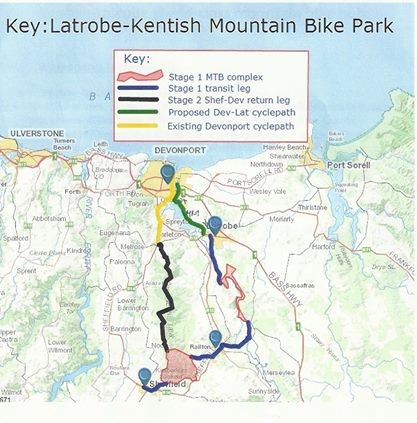 <
<
2. I have known for a while that our concept has made waves on a national level, and that the Australian Mountain Bike Association is watching our progress closely. Yesterday, I received a phone call from the personal assistant to AMBA chief executive Shane Coppin. She said Mr Coppin would be flying down on August 18-20 to discuss our proposal. We have tentatively planned a site visit and discussions for August 19 (subject to his finalised flight details).
3. The Kentish part of this proposal has also progressed. Kentish Council is taking a slightly different approach. On July 24, it advertised seeking professional trail design companies to create a Development Plan for the trails on the western side of Mersey River (Kentish municipality). This Development Plan will include specific track design for that section, plus undertake environmental and cultural assessments of the Kimberleys Lookout-Mersey River site, plus build the basic business case for the project. The trails on the Kentish side will include:
The intention is that the Kentish trails will, by themselves, address all the minimum standards and lengths required to conform to AMBA criteria for hosting major events. That way, we are free in the Warrawee area to develop whatever trails suit us most, without being forced to include trails of a particular type or classification, just to conform to AMBA expectations. This is not to say we wouldn't have Black or Double-Black tracks at Warrawee. I'm just saying we should be freed up to develop whatever tracks suit us and the terrain most.
Latrobe Council resolved at a meeting in May to first look at that Kentish MTB Development Plan before progressing too far with the Warrawee plans, so we can learn from that report and see where we best fit. It will save us quite a lot of money by doing it this way.
A new problem has recently arisen at Kentish, as the identified land is caught up in the forestry debate. Until recently, the land was scheduled to be transferred from Forestry Tas, to Parks & Wildlife, next March. However, the Liberals have torn up the Forestry Peace Deal and halved the amount of Forestry land to be transferred to Parks. Unfortunately, our identified mountain bike site is in the half that will no longer be transferred. We are pursuing a resolution at a political level, but I mention it just to update you on where we are at with that half of the project.
Steps forward from here:
1. It's time for us to gather together all the local enthusiasts who might be interested in this project. I am keen for the local enthusiasts to lead the initial track design by identifying what you would like, where. I will contact the Cradle Coast Mountain Bike Club, and some enthusiasts in Kentish, but I wonder if you might let your contacts know – the more we can involve the better for everybody.
2. After that meeting, we will organise a small working group to come up with a preliminary track design. This first-draft design might have to be fine-tuned to consider Parks & Wildlife's demands, and things we learn from the Kentish report – but I am keen to get our track design process underway so we are not rushed when the official time comes, later this year. Please find attached a Trail Design report that I have found useful. You folks will know a lot of this already, but nonetheless it is a good guide to help us identify the issues before we actually draw lines on maps.
3. Once the Kentish report is received (likely late October or early November), and we have made any adjustments to our plans, we will submit our trail design proposal to Parks & Wildlife. There may or may not be more trail adjustments – depending on if we propose a trail that impacts on a rare plant, or a cultural site or something. That proposal will result in a third (and likely final) draft of the track design.
4. After that, it is about getting the money and resources to build the trails.
It's getting closer!!!!
Source: Update from Chris Frankcombe posted on the Latrobe-Kentish Mountain Bike Trail Network Facebook page 7 August 2014
1. The Reserve Activity Assessment process has begun with Warrawee land manager Parks & Wildlife Service. This is a two-stage process. In Step 1, I have submitted a project proposal to Parks & Wildlife. It states (in general terms) what we want to do, where we want to do it, and how. They look at this proposal, and consider what issues may potentially arise (e.g. impact on flora and fauna, cultural heritage considerations, proximity to riparian environments, future land management and maintenance issues, future land tenure/lease arrangements). Parks then come back with a list of things we have to address, and how they want them addressed. They say they will take two months to assess it and will get back to us by the beginning of October. At that point, we will need specific trail design plans, so, it is time to have a site visit and develop a proposed trail map.
<2. I have known for a while that our concept has made waves on a national level, and that the Australian Mountain Bike Association is watching our progress closely. Yesterday, I received a phone call from the personal assistant to AMBA chief executive Shane Coppin. She said Mr Coppin would be flying down on August 18-20 to discuss our proposal. We have tentatively planned a site visit and discussions for August 19 (subject to his finalised flight details).
3. The Kentish part of this proposal has also progressed. Kentish Council is taking a slightly different approach. On July 24, it advertised seeking professional trail design companies to create a Development Plan for the trails on the western side of Mersey River (Kentish municipality). This Development Plan will include specific track design for that section, plus undertake environmental and cultural assessments of the Kimberleys Lookout-Mersey River site, plus build the basic business case for the project. The trails on the Kentish side will include:
- about 25-30km of trails;
- 25% are Green classification trails, suitable for local families with kids, and those who just want a leisurely ride through the forest.
- 50% are Blue classification trails (intermediate)
- 25% are Black or Double Black classification (required if we are to host a round of the national series; or to get AMBA ratification for our own individual events; and to attract elite-level MTB tourists as well as provide the cutting-edge rides for experienced local riders);
The intention is that the Kentish trails will, by themselves, address all the minimum standards and lengths required to conform to AMBA criteria for hosting major events. That way, we are free in the Warrawee area to develop whatever trails suit us most, without being forced to include trails of a particular type or classification, just to conform to AMBA expectations. This is not to say we wouldn't have Black or Double-Black tracks at Warrawee. I'm just saying we should be freed up to develop whatever tracks suit us and the terrain most.
Latrobe Council resolved at a meeting in May to first look at that Kentish MTB Development Plan before progressing too far with the Warrawee plans, so we can learn from that report and see where we best fit. It will save us quite a lot of money by doing it this way.
A new problem has recently arisen at Kentish, as the identified land is caught up in the forestry debate. Until recently, the land was scheduled to be transferred from Forestry Tas, to Parks & Wildlife, next March. However, the Liberals have torn up the Forestry Peace Deal and halved the amount of Forestry land to be transferred to Parks. Unfortunately, our identified mountain bike site is in the half that will no longer be transferred. We are pursuing a resolution at a political level, but I mention it just to update you on where we are at with that half of the project.
Steps forward from here:
1. It's time for us to gather together all the local enthusiasts who might be interested in this project. I am keen for the local enthusiasts to lead the initial track design by identifying what you would like, where. I will contact the Cradle Coast Mountain Bike Club, and some enthusiasts in Kentish, but I wonder if you might let your contacts know – the more we can involve the better for everybody.
2. After that meeting, we will organise a small working group to come up with a preliminary track design. This first-draft design might have to be fine-tuned to consider Parks & Wildlife's demands, and things we learn from the Kentish report – but I am keen to get our track design process underway so we are not rushed when the official time comes, later this year. Please find attached a Trail Design report that I have found useful. You folks will know a lot of this already, but nonetheless it is a good guide to help us identify the issues before we actually draw lines on maps.
3. Once the Kentish report is received (likely late October or early November), and we have made any adjustments to our plans, we will submit our trail design proposal to Parks & Wildlife. There may or may not be more trail adjustments – depending on if we propose a trail that impacts on a rare plant, or a cultural site or something. That proposal will result in a third (and likely final) draft of the track design.
4. After that, it is about getting the money and resources to build the trails.
It's getting closer!!!!
Source: Update from Chris Frankcombe posted on the Latrobe-Kentish Mountain Bike Trail Network Facebook page 7 August 2014
Stay Informed
When you subscribe to the blog, we will send you an e-mail when there are new updates on the site so you wouldn't miss them.
About the author
Comments
No comments made yet. Be the first to submit a comment